- GAN-Based Dual Image Super Resolution for Satellite Imagery Decreasing Radiometric Uncertainty. ISPRS Annals of the Photogrammetry, Remote Sensing and Spatial Information Sciences, ISPRS Annals of the Photogrammetry, Remote Sensing and Spatial Information Sciences, 2024, 155--162 more… BibTeX Full text ( DOI )
- Grundlagen zur automatisierten Ermittlung hochgenauer Passpunkte für CubeSat-Satellitenbilder mittels Deep-Learning-gestützter Delaunay-Triangulation basierend auf Gebäudedaten des Liegenschaftskatasters. zfv – Zeitschrift für Geodäsie, Geoinformation und Landmanagement 148 (2/2023), 2023, 66-93 more… BibTeX Full text ( DOI )
- Bayerisches Satellitennetzwerk für Fernerkundung und Biomonitoring. zfv – Zeitschrift für Geodäsie, Geoinformation und Landmanagement 148 (4/2023), 2023, 219-229 more… BibTeX Full text ( DOI )

Michael Greza, M.Sc.
- Tel.: +49 89 289 22672
- Raum: 0507.01.772
- E-Mail: michael.greza@tum.de
CuBy - Satellite Network Bavaria
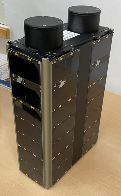
This unique project encompasses the development of a multispectral small satellite Earth observation mission for the state of Bavaria.
Research areas within this project:
Mission design
Payload and design evaluation
Payload simulation
Camera calibration
Image registration and georeferencing (machine-learning-based)
Cloud masking (machine-learning-based)
Super resolution (machine-learning-based)
Other Projects
AI Detective - Cooperation with Landeskriminalamt Bayern
Research cooperation for the development of machine learning approaches for digital twins of crime scenes.
Visual Investigations - Exhibition at Pinakothek der Moderne
Support of Architectural Museum of TUM in creating an exhibition on methods of photogrammetry & remote sensing to detect, document and solve cases of human rights violations.
Exhibition: 10th October 2024 - 9th February 2025 at Pinakothek der Moderne
More information