Willkommen bei der Professur für Fernerkundungsanwendungen!
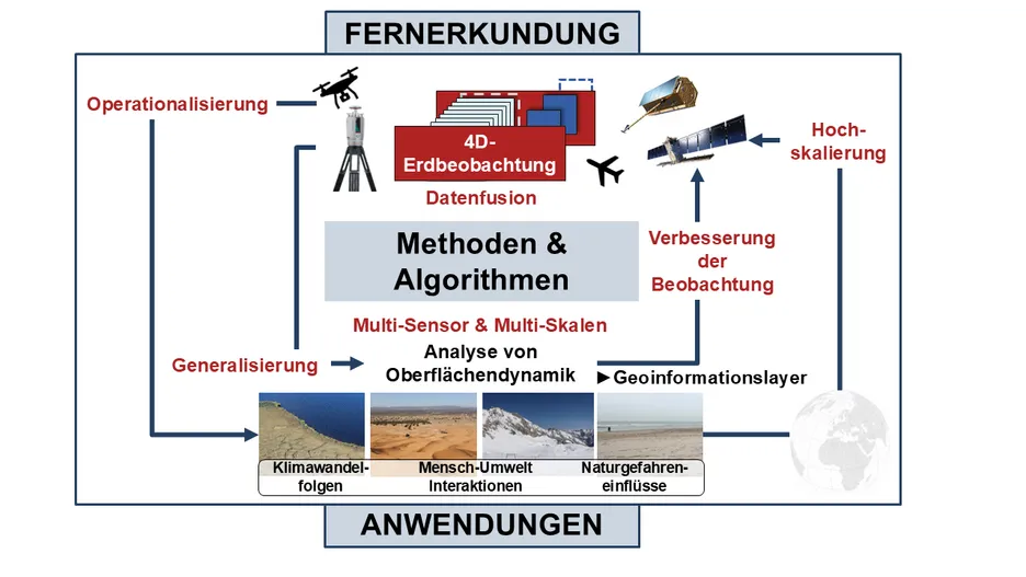
Wir entwickeln und wenden automatisierte Methoden zur Analyse von Fernerkundungsdaten an, um Informationen und neue wissenschaftliche Erkenntnisse über Erdoberflächenprozesse zu gewinnen. Unser Schwerpunkt liegt auf der Beobachtung der topographischen Landschaftsdynamik im Kontext von Naturgefahrenmanagement, Auswirkungen des Klimawandels und Mensch-Umwelt-Interaktionen. Ein wichtiges Ziel ist die Operationalisierung von 4D-Beobachtungsstrategien durch Spezialisierung für verschiedene Anwendungen in den Geowissenschaften und im Umweltmonitoring.
Fernerkundungsdaten aus verschiedenen Quellen werden genutzt und kombiniert, um unterschiedliche Raum-Zeit-Skalen von Prozessen an der Erdoberfläche abzudecken – von terrestrischen 3D-Messungen (Laserscanning und Photogrammetrie) über luftgestützte Messungen (UAVs und Flugzeuge) bis hin zu Satellitenbeobachtungen. Ein besonderer Schwerpunkt liegt auf der kontinuierlichen 3D-Beobachtungen, d.h. Zeitreihenanalysen, um die raum-zeitliche Lücke zwischen lokalen, sporadischen, hoch detaillierten Messungen und großflächigen Satellitenbeobachtungen zu schließen.