- The 1st International Workshop on the Quality of Geodeic Observation and Monitoring Systems (QuGOMS'11). Band 140. IAG Symposia. Springer, 2015 mehr… BibTeX
- Observing Mass Transport to Understand Global Change and Benefit Society: Science and User Needs. Verlag der Bayerischen Akademie der Wissenschaften in Kommission beim Verlag C.H. Beck, 2015, mehr… BibTeX
- Time Variable Gravity: Contributions of GOCE Satellite Data to Monthly and Bi-monthly GRACE Gravity Field Estimates. Proceedings of the International Symposium on Gravity, Geoid and Height Systems (GGHS2012), Springer, 2015 mehr… BibTeX Volltext ( DOI )
- Validation of Regional Geoid Models for Saudi Arabia Using GPS/Levelling Data and GOCE Models. Proceedings of the IAG Symposium GGHS2012, October 9-12, 2012, Venice, Italy, Springer, 2015 mehr… BibTeX Volltext ( DOI )
- A surface spherical harmonic expansion of gravity anomalies on the ellipsoid. Journal of Geodesy 89 (10), 2015, 1035-1048 mehr… BibTeX Volltext ( DOI ) Volltext (mediaTUM)
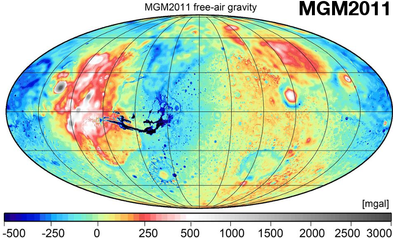
- Ultra-high-Degree Surface Spherical Harmonic Analysis Using the Gauss-Legendre and the Driscoll/Healy Quadrature Theorem and Application to Planetary Topography Models of Earth, Mars and Moon. Surveys in Geophysics 36 (6), 2015, 803-830 mehr… BibTeX Volltext ( DOI ) Volltext (mediaTUM)
- Topographic evaluation of fifth-generation GOCE gravity field models - globally and regionally. In: Newton's Bulletin 5, Special issue on validation of GOCE gravity fields, International Association of Geodesy. IAG, 2015, 1-24 mehr… BibTeX Volltext (mediaTUM)
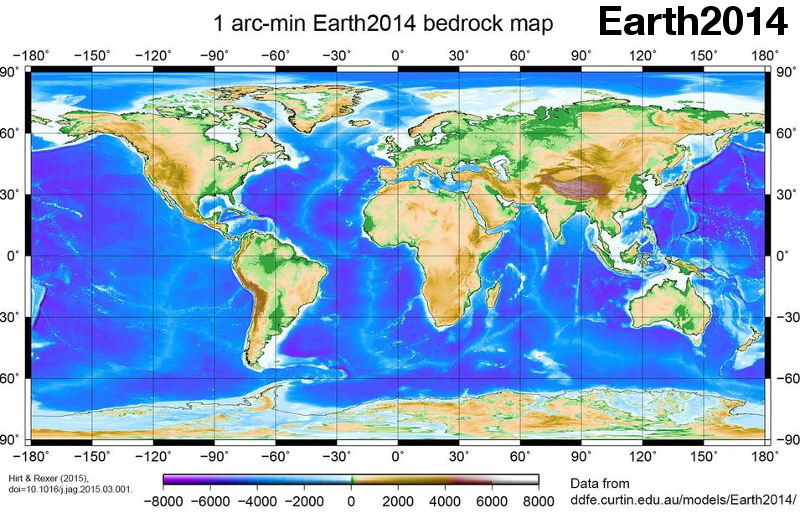
- Earth2014: 1' shape, topography, bedrock and ice-sheet models - Available as gridded data and degree 10,800 spherical harmonics. International Journal of Applied Earth Observation and Geoinformation 39, 2015, 103-112 mehr… BibTeX Volltext ( DOI ) Volltext (mediaTUM)
- Use of topography in the context of the GOCE satellite mission - some examples. Proc. '5th International GOCE User Workshop', Paris, France, 25-28 November 2014, ESA Communications, 2015 mehr… BibTeX Volltext (mediaTUM)
- Remote Sensing of Storage Fluctuations of Poorly Gauged Reservoirs and State Space Model (SSM)-Based Estimation. Remote Sensing (7), 2015, 17113–17134 mehr… BibTeX Volltext ( DOI ) Volltext (mediaTUM)
- Spectral analysis of the Earth’s topographic potential via 2D-DFT: a new data-based degree variance model to degree 90,000. Journal of Geodesy 89 (9), 2015, 887-909 mehr… BibTeX Volltext ( DOI ) Volltext (mediaTUM)
- GIOVE-B solar radiation pressure modeling for precise orbit determination. Advances in Space Research 55 (5), 2015, 1422-1431 mehr… BibTeX Volltext ( DOI )
- Neotectonic characteristics along the eastern flank of the Central Range in the active Taiwan orogen inferred from fluvial channel morphology. Tectonics 34 (10), 2015, 2249-2270 mehr… BibTeX Volltext ( DOI )
- Space geodetic observation of the deformation cycle across the Ballenas Transform, Gulf of California. Journal of Geophysical Research: Solid Earth 120 (8), 2015, 5843-5862 mehr… BibTeX Volltext ( DOI )
- The BeiDou Navigation Message. Proceedings of IGNSS 2013, 2014 mehr… BibTeX
- Combination of ground- and space-based GPS data for the determination of a multi-scale regional 4-D ionosphere model (accepted). International Association of Geodesy Symposia, 2014 mehr… BibTeX
- Precise Mean Orbital Elements Determination for LEO Monitoring and Maintenance. Proceedings of 24th International Symposium on Space Flight Dynamics (ISSFD), 2014 mehr… BibTeX
- Identification of Errors in 3D Building Models by a Robust Camera Pose Estimation. Proceedings of Photogrammetric Computer Vision - PCV 2014,, 2014 mehr… BibTeX
- Differential Code Bias Estimation using Multi-GNSS Observations and Global Ionosphere Maps. Proceedings of ION-ITM 2014, Institute of Navigation, 2014 mehr… BibTeX
- Texturierung von 3D Gebäudemodellen unter Verwendung von Schrägsichtaufnahmen flugzeuggetragener TIR-Kameras. DGPF Tagung, 2014 mehr… BibTeX
- Progress Report on the WLRS: Getting ready for GGOS, LLR and Time Transfer. Proceedings of the 18th International Workshop on Laser Ranging, 2014 mehr… BibTeX
- European Laser Time Transfer (ELT) and Laser Safety for the ISS. Proceedings of the 18th International Workshop on Laser Ranging, 2014 mehr… BibTeX
- Coregistration refinement of hyperspectral images and DSM: An object-based approach using spectral information. ISPRS Journal of Photogrammetry and Remote Sensing, 2014 mehr… BibTeX Volltext ( DOI )
- Earth and space observation at the German Antarctic Receiving Station O'Higgins. Polar Record, 2014 mehr… BibTeX Volltext ( DOI )
- Photogrammetry and remote sensing in the MSc programme ESPACE at Technische Universitaet Muenchen. ISPRS Annals of the Photogrammetry, Remote Sensing and Spatial Information Sciences, ISPRS Technical Commission VI Symposium, 19 21 May 2014, 2014 mehr… BibTeX Volltext ( DOI )
Ingenieurinstitut für Astronomische und Physikalische Geodäsie
Das Ingenieurinstitut besteht aus:

Lehrstuhl für Astronomische und Physikalische Geodäsie
Univ.-Prof. Dr.techn. Mag.rer.nat. Roland Pail

Professur für Satellitengeodäsie
Univ.-Prof. Dr.phil.nat. Urs Hugentobler


