Earth2014 global topography (relief) model
General
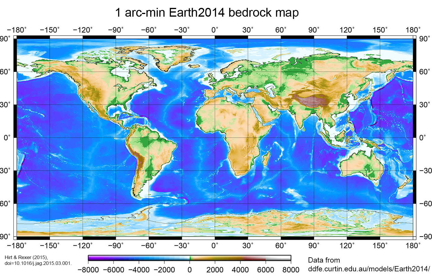
Earth2014 is a freely-available suite of global topography, bathymetry and ice-sheet grids developed at Curtin University (Perth) and TU Munich (Hirt and Rexer 2015). The Earth2014 products, constructed based on newest topography data sets that were available in 2014, have been released in 2015. The Earth2014 grids offer topography data with global coverage at 1 arc-minute (about 1.8 km) spatial resolution and may be suitable for applications such as global gravity modelling, particularly forward modelling, geo-visualisation (Fig. 1) and geophysical studies.
The topography layers (e.g., bedrock, surface topography, ice) are the primary product. A number of derived or auxiliary products are available such as (1) Earth shape models (surface heights w.r.t geocenter), (2) spherical harmonic series expansions of the gridded data with ultra-high resolution (harmonic degree 10800), (3) data set masks and (4) down-sampled grids of coarser resolution (5 arc-min).
Download and citation
All Earth2014 data sets can be obtained via the repository
http://ddfe.curtin.edu.au/models/Earth2014
Please consult the readme-file for details on the data products and the various data formats (binary, GMT-grid).
http://ddfe.curtin.edu.au/models/Earth2014/readme_earth2014.dat
The Earth2014 citation is:
Hirt, C. and Rexer, M. (2015) Earth2014: 1 arc-min shape, topography, bedrock and ice-sheet models - available as gridded data and degree-10,800 spherical harmonics, International Journal of Applied Earth Observation and Geoinformation 39, 103-112, doi:10.1016/j.jag.2015.03.001. PDF
Input data and model development
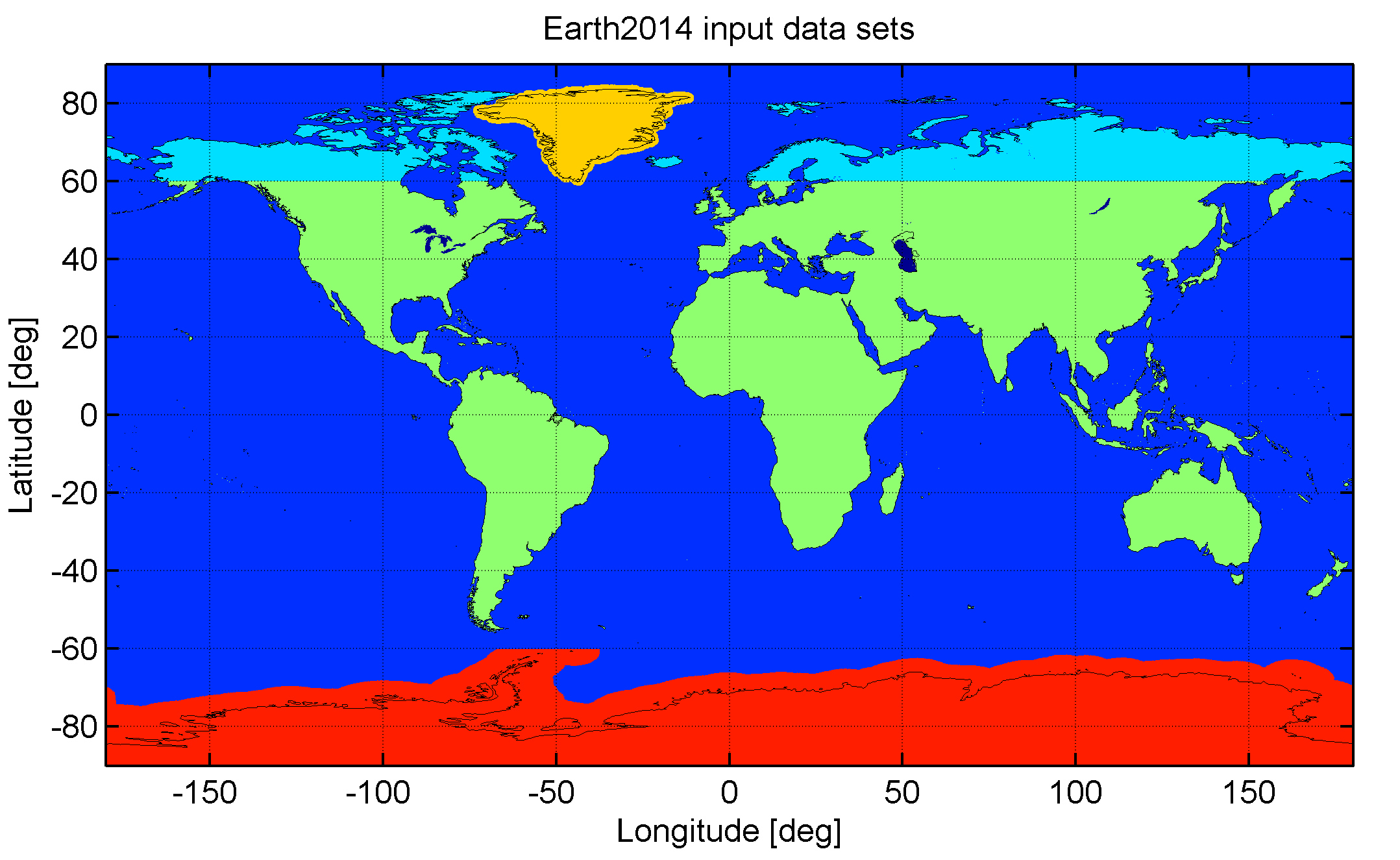
The Earth2014 model suite is based on the four input data sets (a) Bedmap2 (Fretwell et al. 2013) bedrock and ice data over Antarctica, (b) GBT v3 Greenland bedrock topography data over Greenland (Bamber et al. 2013), (c) SRTM30_PLUS v9 (Becker et al. 2009) bathymetry over the oceans and major inland lakes, and over land in high northern latitudes (except for Greenland), and (d) SRTM V4.1 Topography (Jarvis et al. 2008) over continents/islands (Fig. 2) The procedures used to combine the input data sets of Earth2014 are detailed in the Hirt and Rexer (2015) paper.
Results and visual impressions of the Earth2014 products
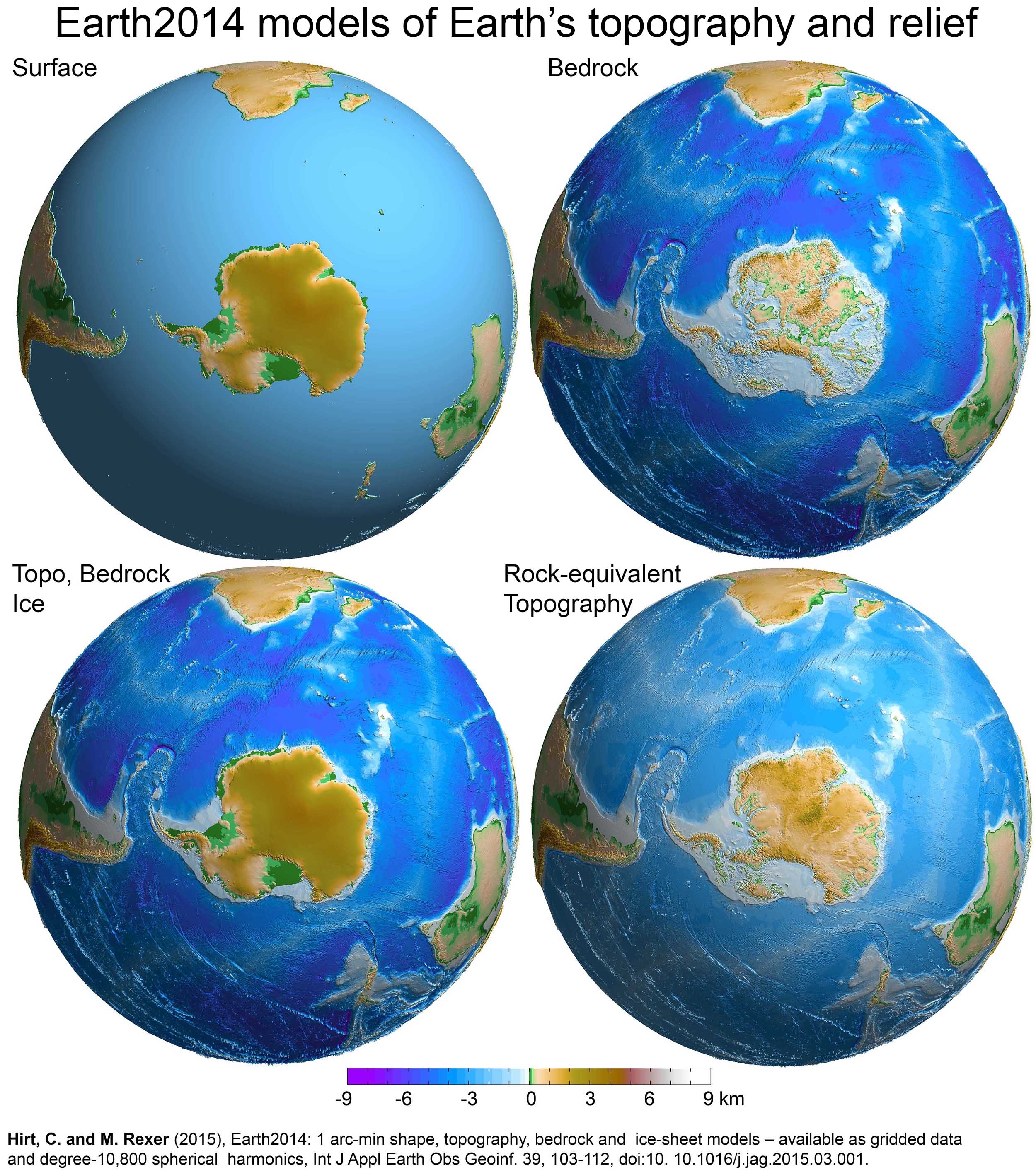
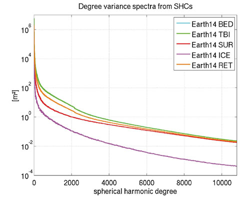
Earth2014 topography data is provided in terms of the five layers SUR (lower interface of the atmosphere), BED (Earth relief without water and ice), TBI (topography over land, bathymetry over the oceans and top of ice-sheets over Antarctica and Greenland), ICE (ice thickness = ice sheet heights) and RET (rock-equivalent topography). Selected Earth2014 layers are shown in Fig. 3. Degree variances computed from the degree-10800 spherical harmonic expansions of the Earth2014 grids are displayed in Fig. 4.
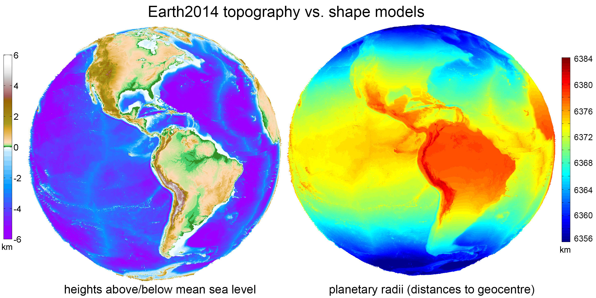
Differences between the Earth2014 topography (heights relative to the mean sea level) and shape grids (geocentric radii relative to the geocenter) are shown in Fig. 5. The right panel nicely shows the (geometrical) shape of planet Earth, a lesser known perspective on our planet.
Acknowledgement
This work has been supported by the TUM Institute for Advanced Study. All data providers are kindly acknowledged.
Contact
Dr. Christian Hirt, Dr. Moritz Rexer
References
Bamber, J.L. et al. (2013), A new bed elevation dataset for Greenland. The Cryosphere, 7, 499-510.
Becker, J.J., D.T. Sandwell, W.H.F. Smith, et al. (2009), Global Bathymetry and Elevation Data at 30 Arc Seconds Resolution: SRTM30_PLUS. Marine Geodesy 32(4): 355-371.
Fretwell, P. et al. (2013), Bedmap2: improved ice bed, surface and thickness datasets for Antarctica, The Cryosphere, 7, 375-393.
Hirt, C. and M. Rexer (2015), Earth2014: 1 arc-min shape, topography, bedrock and ice-sheet models - available as gridded data and degree-10,800 spherical harmonics, International Journal of Applied Earth Obs. and Geoinf.n 39, 103-112. PDF
Jarvis, A., H.I. Reuter, A. Nelson, and E. Guevara (2008), Hole-filled SRTM for the globe Version 4, Available from the CGIAR-CSI SRTM 90m database : http://srtm.csi.cgiar.org.