The DLR Executive Board has awarded the DLR Science Prize of 2021 to the paper "Study of Systematic Bias in Measuring Surface Deformation with SAR Interferometry" by Dr.-Ing. Homa Ansari, Dr. Eng. Francesco de Zan and Mr. Alessandro Parizzi.
SAR-Interferometric ground motion measurement is one of the most powerful and unique application of Synthetic Aperture Radar (SAR) data from Earth observation satellites. With this technique, ground subsidence (e.g., caused by mining, underground work or loading of unstable soil), landslides, built infrastructure deformation (e.g. by thermal stress or material fatigue) and uplift (e.g. by volcanism, climate change or glacial rebound) can be measured from space with an accuracy of 1 mm/year. For three decades, SAR-interferometric data have been used in science, industry and governance for geo-research, infrastructure monitoring and for managing geo-risks. Entire countries have been mapped using this technique; a European-wide mapping, is currently being commissioned. So far, two well established classes of algorithms for ground motion detection from SAR dominated in the community: the Persistent Scattere Interferometry (PSI) and the Small BAseline Subset (SBAS) algorithm, each with individual pros and cons, PSI generally offering higher accuracy at the price of numerical complexity and SBAS providing higher spatial density and lower complexity. Therefore, SBAS was considered as an attractive alternative to PSI and used by many scientists and commercial companies over many years.
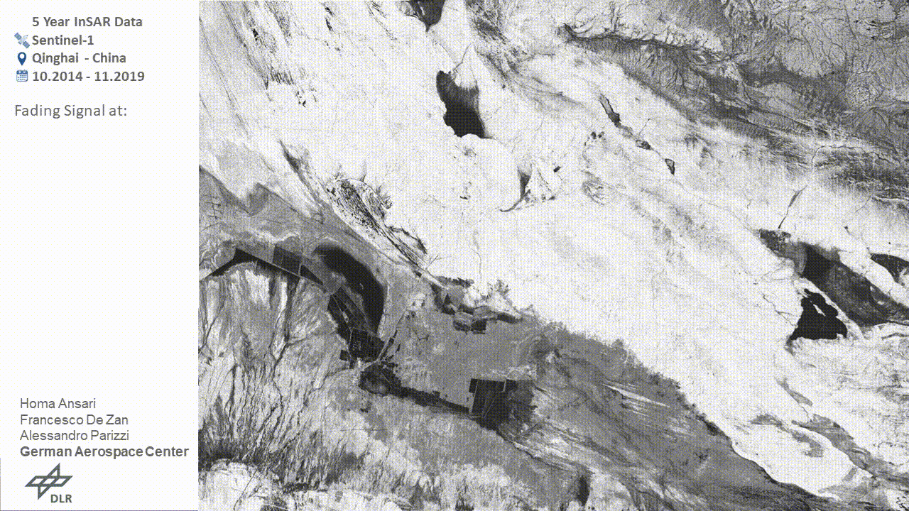
In their award-winning paper our scientists demonstrate convincingly, that SBAS suffers from severe error fluctuations that had neither been noticed nor quantified so far. Obviously, this fact was initially received with severe distrust in the community. But scientific talks of Ms. Dr. Ansari at international conferences and following complaisant discussions with the critics, as well as cross-comparison of results among well-established academic groups, led to a general acceptance. The authors not only proved, that even a well-established algorithm (SBAS has been used in the community since 2004) may be severely in error, they quantified these errors independent of configuration settings, they developed new theories for the origin of these errors, and they developed new algorithms to minimize these errors. The authors attributed the errors to a systematic signal, which is coined as the fading signal (see the animation below). The work is a critical milestone for established algorithms, and at the same time a promising and solid basis for future satellite Big Data processing chains for ground motion measurement. The proposed methods increase the accuracy (compared to SBAS) by an improved algorithmic design approaching the optimal quality achieved by PSI, and they reduce the cost of processing (compared to PSI) by a massive reduction of numeric complexity. They are of high relevance for the current Copernicus SAR mission Sentinel-1 and for coming ground segments of ESA/Copernicus (BIOMASS, ROSE-L) or NASA/JPL (NISAR) and for possible German missions such as HRWS.
Reference: Ansari, H., De Zan, F. and Parizzi, A., 2020. Study of systematic bias in measuring surface deformation with SAR interferometry. IEEE Transactions on Geoscience and Remote Sensing, 59(2), pp.1285-1301. [article]