
Topics & Projects
From our own satellite missions to research into hyperloop technology - scientists at the Department of Aerospace and Geodesy are pursuing numerous and promising projects across the various disciplines. The core competence is located at our chairs and professorships, which conduct research in all subfields of aerospace and geodesy at the highest international level. It is particularly important to us that our research leads to the direct application of findings and the integration of various technologies in the overall system. Practice-oriented modules in our degree programs and the promotion of entrepreneurship encourage student initiatives and innovation in the faculty environment. Dedicated students thus steer their very own initiatives and make a name for themselves in national and international competitions.
Hyperloop: Tube Transport made in Bavaria
A high-speed train that travels through a tube at close to the speed of sound: What sounds like science fiction is becoming reality in Bavaria. The TUM Hyperloop Program will both develop and test the necessary technologies and conduct a systems analysis of future technical and economic feasibility. Fueled by the passion of the student initiative and funded by the Bavarian State Government, preparatory work for a large, interdisciplinary research program on Hyperloop has been underway at the Department of Aerospace and Geodesy since 2018. Many professorships and chairs from different areas of the university are participating in the new TUM Hyperloop program. The many competencies of the University of Excellence come together in this highly interdisciplinary research area. As before, many motivated students are involved in the program, coordinated by the non-profit association NEXT Prototypes e.V.
In 2013, Elon Musk presented a concept for a ground-based high-speed transport system in a white paper: the so-called Hyperloop. The Hyperloop consists of a partially evacuated tube in which capsules move to transport people and goods. In a partial vacuum and by using a contactless levitation and propulsion system, it should be possible to significantly reduce rail travel times. At the same time, despite fast travel times, the Hyperloop is much more environmentally friendly than airplanes. The publication of the concept sparked great interest worldwide for novel, climate-neutral high-speed transport systems.
"At the Technical University of Munich, the Hyperloop vision is becoming a reality. Here, we bring together expertise from different fields such as propulsion and high-performance engineering, lightweight construction, traffic route engineering and engineering geodesy to develop a functioning and safe technology for the superfast train. Add to this the pioneering spirit, enthusiasm and invaluable experience of the student TUM Hyperloop team, which has already built several prototypes of the transport capsule and emerged victorious four times in a row as world speed champion at the SpaceX Hyperloop Pod Competition in Los Angeles. The Faculty of Aeronautics, Astronautics and Geodesy at the Ottobrunn/Taufkirchen site is the ideal place to specifically develop this knowledge and foster our young talents' passion for innovative technologies of the future."
Prof. Thomas F. Hofmann, President of TUM
Technology development
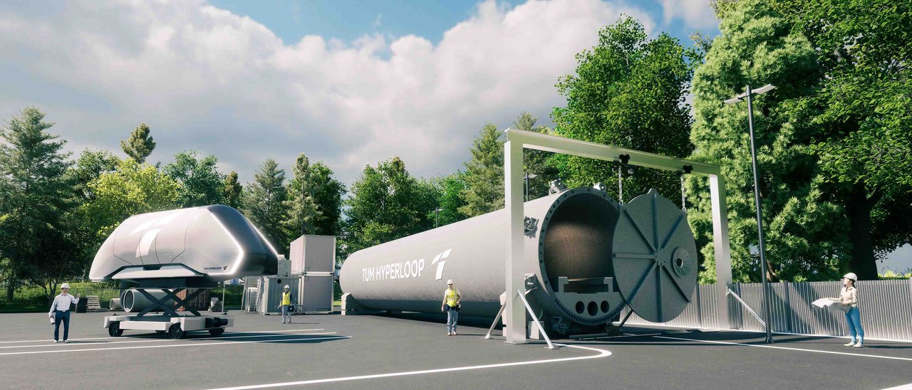
Between 2020 and 2022, a full-scale technology demonstrator will be developed and built. The demonstrator will consist of a 24-meter-long vacuum tube and a matching human-sized capsule. The technical implementation is crucial for the development of a future Hyperloop system. Integration and functional tests are to be carried out on the demonstrator in order to identify problems at an early stage and explore solutions that make technical and economic sense. In addition, experimental data will be collected that can be used for concept analysis.
Concept analysis
Parallel to the development and testing of the technology, modeling and analysis of the researched system as well as its large-scale implementation are necessary. This will test various concepts for technical and economic feasibility and improve system capability in the long term. In addition, potential safety risks will be investigated and identified at an early stage, and suitable measures will be developed. Finally, proposals for suitable implementation options in the existing traffic infrastructure are to emerge from these investigations.
MOVE III: Students explore space debris
The Munich Orbital Verification Experiment, or MOVE for short, is the satellite technology group of the student association WARR. For 15 years, the central mission of our team has been to educate students through hands-on experience and to provide them with access to unique sources of knowledge. To this end, the team develops dedicated satellite hardware and tests it in space using so-called CubeSats - a standardized variant of nanosatellite. MOVE has already sent three 1U CubeSats (10x10x11.3cm satellites) into space, and is still actively in contact with one of these satellites.
In addition, the MOVE project allows students to participate in workshops provided by chairs and external companies/institutions, to publish papers with the team and PhD students of the university, and to gain research experience.
For more information, please contact the MOVE team at satelliten@warr.de or visit our website at https://warr.de/projects/move/.