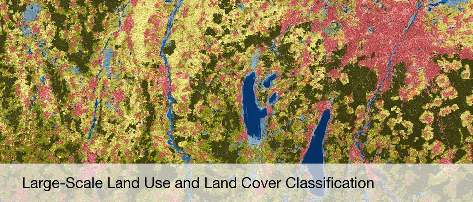
Information and knowledge from remote sensing data
Satellite- and Airplane-based Earth Observation
Synthetic Aperture Radar (SAR) and SAR Interferometry
High Resolution Optical Image Interpretation
Hyperspectral Earth Observation
Estimation Theory
Sparse Reconstruction and Compressive Sensing
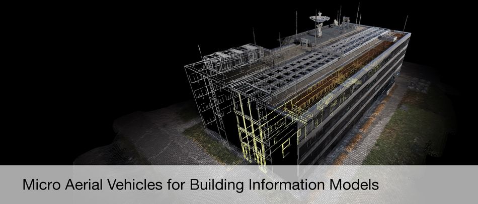
3D Reconstruction
4D Motion Detection
Data Fusion
Computer Vision
Machine Learning
Deep Learning
Recent Publications
Koch, Tobias; Körner, Marco; Fraundorfer, Friedrich: Automatic Alignment of Indoor and Outdoor Building Models using 3D Line Segments. Proceedings of the IEEE Conference on Computer Vision and Pattern Recognition Workshops, 2016 more…
Koch, Tobias; d'Angelo, Pablo; Kurz, Franz; Fraundorfer, Friedrich; Reinartz, Peter; Körner, Marco: The TUM-DLR Multimodal Earth Observation Evaluation Benchmark. The IEEE Conference on Computer Vision and Pattern Recognition (CVPR) Workshops, 2016 more…
Kang, Jian; Wang, Yuanyuan; Körner, Marco; Zhu, Xiao Xiang: Object-based InSAR deformation reconstruction with application to bridge monitoring. IEEE International Geoscience and Remote Sensing Symposium (IGARSS), 2016 more…
Shahzad, Muhammad; Zhu, Xiao Xiang: Automatic Detection and Reconstruction of 2D/3D Building Shapes from Spaceborne TomoSAR Point Clouds. Transactions on Geoscience and Remote Sensing, 2015 more…
Wang, Yuanyuan; Zhu, Xiao Xiang: InSAR Forensics: Tracing InSAR Scatterers in High Resolution Optical Image. Proceedings of FRINGE Workshop, 2015 more…