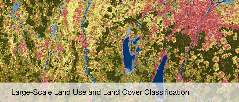
Information and knowledge from remote sensing data
Satellite- and Airplane-based Earth Observation
Synthetic Aperture Radar (SAR) and SAR Interferometry
High Resolution Optical Image Interpretation
Hyperspectral Earth Observation
Estimation Theory
Sparse Reconstruction and Compressive Sensing
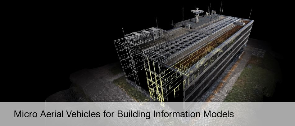
3D Reconstruction
4D Motion Detection
Data Fusion
Computer Vision
Machine Learning
Deep Learning
Recent Publications
Frey, D.; Butenuth, M.; Hinz, S.: A Modular System for Road Updating, Refinement and Classification from Satellite Images. Photogrammetrie Fernerkundung Geoinformation 6, 2010, 453-464 more…
Koller, M.; Butenuth, M.; Gerke, M.: Automatic Road-Tracking in Airborne Image Sequences. Photogrammetrie Fernerkundung Geoinformation 5, 2010, 325-336 more…
Auer, S.; Hinz, S.; Bamler, R.: Ray-Tracing Simulation Techniques For Understanding High-Resolution SAR Images. IEEE Transactions on Geoscience and Remote Sensing 48, 2010, 1445-1456 more…
Zhu, X. X.; Bamler, R.: Very High Resolution Spaceborne SAR Tomography in Urban Environment. IEEE Transactions on Geoscience and Remote Sensing 48 (12), 2010, 4296-4308 more…
Zhu, X. X.; Bamler, R.: Tomographic SAR Inversion by L1 Norm Regularization - The Compressive Sensing Approach. IEEE Transactions on Geoscience and Remote Sensing 48 (10), 2010, 3839-3846 more…