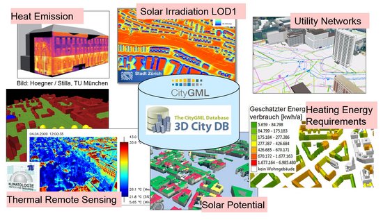
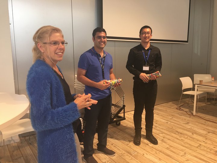
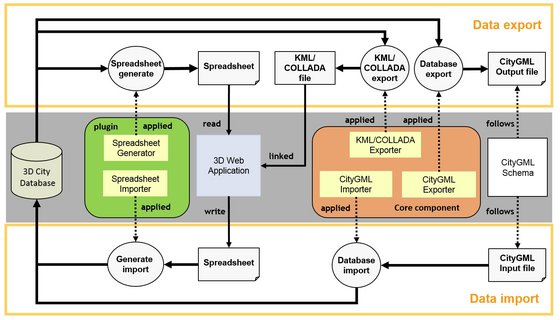
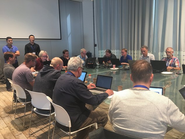
Am 27. und 28. September 2016 haben Kanishk Chaturvedi und Zhihang Yao auf Einladung von Prof. Jantien Stoter im Rahmen des Workshops 3DViz 2016 an der TU Delft einen zweitägigen Kurs über die 3DCityDB und Browser-basierte 3D-Geovisualisierung gehalten. Die Kursmaterialien sind nunmehr unter der Creative Commons License veröffentlicht und können von der 3DCityDB-Projektseite heruntergeladen werden. Die Präsentationen wurden von der TU Delft aufgezeichnet und können ebenfalls über die 3DCityDB-Projektseite abgerufen werden.
2024
- Recent Advances in 3D Geoinformation Science – Proceedings of the 18th 3D GeoInfo Conference. Lecture Notes in Geoinformation and Cartography. Springer, 2024 mehr… BibTeX
- Multimodale Navigationsanwendungen für CityGML 3.0-konforme 3D-Straßenraummodelle mittels Graphdatenbanken. 44. Wissenschaftlich-Technische Jahrestagung der DGPF in Remagen – Publikationen der DGPF, Deutsche Gesellschaft für Photogrammetrie, Fernerkundung und Geoinformation e.V., 2024, 357-369 mehr… BibTeX
2023
- Automatically evaluating the service quality of bicycle paths based on semantic 3D city models. Lecture Notes in Geoinformation and Cartography - Recent Advances in 3D Geoinformation Science - Proceedings of the 18th 3D GeoInfo Conference, 2023 mehr… BibTeX
- Requirements for Web-based 4D Visualisation of Integrated 3D City Models and Sensor Data in Urban Digital Twins. Lecture Notes in Geoinformation and Cartography - Recent Advances in 3D Geoinformation Science - Proceedings of the 18th 3D GeoInfo Conference, 2023 mehr… BibTeX
- Multimodal Navigation Applications for CityGML 3.0 using a Graph Database. Masterarbeit, 2023 mehr… BibTeX
2022
- Dynamic and web-based 4D visualization of streetspace activities derived from traffic simulations and semantic 3D city models. Proceedings of the 17th International 3D GeoInfo Conference 2022 , 2022 mehr… BibTeX
- Semantic segmentation of roof superstructures. Masterarbeit, 2022 mehr… BibTeX
- Improving CNN roof segment detection by dataset extension using 3D city models. Projektarbeit, 2022 mehr… BibTeX
- Zusammenführung von Luftbild- und 3D-basierter Photovoltaik-Potenzialanalyse. Masterarbeit, 2022 mehr… BibTeX
- Deep Learning for Semantic 3D City Model Extension: Modeling Roof Superstructures using Aerial Images for Solar Potential Analysis. ISPRS Annals of the Photogrammetry, Remote Sensing and Spatial Information Sciences (ISPRS Annals of the Photogrammetry, Remote Sensing and Spatial Information Sciences), 2022 mehr… BibTeX
- Interactive Retrieval and Exploration of Information Resources by Coupling of a 3D Web Viewer and a Smart City Catalog Service. Masterarbeit, 2022 mehr… BibTeX
2021
- Integration of 3D point clouds with semantic 3D city models – Providing semantic information beyond classification. Proceedings of the 16th International 3D GeoInfo Conference 2021 ( ISPRS Annals of the Photogrammetry, Remote Sensing and Spatial Information Sciences ), 2021, 105--112 mehr… BibTeX
- Kopplung von Simulationssoftware mit Semantischen 3DStadtmodellen für Urbane Mikroklimasimulation. Masterarbeit, 2021 mehr… BibTeX
- Extending the Calibration of the Transition Model for Calculating Solar Radiation Values. IDP-Arbeit, 2021 mehr… BibTeX
2020
- Combined modelling of multiple transportation infrastructure within 3D city models and its implementation in CityGML 3.0. Proceedings of the 15th International 3D GeoInfo Conference 2020 ( ISPRS Annals of the Photogrammetry, Remote Sensing and Spatial Information Sciences ), ISPRS , 2020 mehr… BibTeX
- Detailed Streetspace Modelling for Multiple Applications: Discussions on the Proposed CityGML 3.0 Transportation Model. ISPRS International Journal of Geo-Information 9 (10), 2020, 603 mehr… BibTeX
- Solarpotentialanalyse auf Basis von 3D-Stadtmodellen – Performance und Ergebnisqualität. Bachelorarbeit, 2020 mehr… BibTeX
- Life Cycle Assessment of Technical Building Services of Large Residential Building Stocks using Semantic 3D City Models. ISPRS Annals of Photogrammetry, Remote Sensing and Spatial Information Sciences VI-4/W1-2020, 2020, 85-92 mehr… BibTeX
- 3DCityDB4BIM: A System Architecture for Linking BIM Server and 3DCityDB for BIM-GIS-Integration. Proceedings of the XXIV ISPRS Congress (ISPRS Annals of Photogrammetry, Remote Sensing and Spatial Information Sciences), Copernicus GmbH, 2020, 195-202 mehr… BibTeX
2019
2018
- Securing Spatial Data Infrastructures in the Context of Smart Cities. 2018 International Conference on CYBERWORLDS (CW 2018), 2018, 403-408 mehr… BibTeX
- Spatio-Semantic Comparison of Large 3D City Models in CityGML Using a Graph Database. gis.Science (3/2018), 2018, 85-100 mehr… BibTeX
- A new Approach to Model Transformation using Graph Transformation System. PFGK18 - Photogrammetrie - Fernerkundung - Geoinformatik - Kartographie, 37. Jahrestagung in München 2018 (Publikationen der Deutschen Gesellschaft für Photogrammetrie, Fernerkundung und Geoinformation (DGPF) e.V. 27), Deutsche Gesellschaft für Photogrammetrie, Fernerkundung und Geoinformation e.V., 2018, 831-834 mehr… BibTeX
- 3DCityDB - a 3D geodatabase solution for the management, analysis, and visualization of semantic 3D city models based on CityGML. Open Geospatial Data, Software and Standards 3 (5), 2018, 1-26 mehr… BibTeX
2017
- Integrating and Managing the Information for Smart Sustainable Districts - The Smart District Data Infrastructure (SDDI). In: Geoinformationssysteme 2017 – Beiträge zur 4. Münchner GI-Runde. . Wichmann Verlag , 2017 mehr… BibTeX
- Visualizing dynamic spatial height information in a dam monitoring context. Masterarbeit, 2017 mehr… BibTeX
- Detaillierte Repräsentation des Straßenraums in 3D-Stadtmodellen. Masterarbeit, 2017 mehr… BibTeX
- CityGML and the streets of New York - A proposal for detailed street space modelling. Proceedings of the 12th International 3D GeoInfo Conference 2017 (ISPRS Annals of the Photogrammetry, Remote Sensing and Spatial Information Sciences), ISPRS, 2017, 9-16 mehr… BibTeX
- Effizientes Management und 3D-Visualisierung von großen DGM in einem räumlichen Datenbanksystem. Bachelorarbeit, 2017 mehr… BibTeX
- 3D-Stadtmodelle nach CityGML-Standard als Planungsinstrument für BIM-Infrastrukturprojekte am Beispiel der U4-Netzerweiterung auf die Horner Geest in Hamburg. Studienarbeit, 2017 mehr… BibTeX
- Erweiterung eines Open Source 3D-Webclients zur interaktiven Darstellung von zeitabhängigen Gebäudetexturen. Bachelorarbeit, 2017 mehr… BibTeX
- Spatio-semantic Comparison of 3D City Models in CityGML using a Graph Database. Masterarbeit, 2017 mehr… BibTeX
- Kopplung von Verkehrssimulation und semantischen 3D-Stadtmodellen in CityGML. Masterarbeit, 2017 mehr… BibTeX
- Dynamically Extending Spatial Databases to support CityGML Application Domain Extensions using Graph Transformations. Kulturelles Erbe erfassen und bewahren - Von der Dokumentation zum virtuellen Rundgang, 37. Wissenschaftlich-Technische Jahrestagung der DGPF (Publikationen der Deutschen Gesellschaft für Photogrammetrie, Fernerkundung und Geoinformation (DGPF) e.V.), Deutsche Gesellschaft für Photogrammetrie, Fernerkundung und Geoinformation e.V., 2017, 316-331 mehr… BibTeX
2016
- Nutzung von Smartphone-Sensoren zur Navigation in der Kartenansicht eines 3D-Webclients. Bachelorarbeit, 2016 mehr… BibTeX
- 3D Solar Potential Modelling and Analysis: A case study for the city of Utrecht. 32nd European Photovoltaic Solar Energy Conference and Exhibition, EUPVSEC 2016, 2016 mehr… BibTeX
- Smart Data Infrastructure for Smart and Sustainable Cities. 13th International Conference on Design & Decision Support Systems in Architecture and Urban Planning , 2016DDSS 2016 mehr… BibTeX
- Semantic 3D City Models Serving as Information Hub for 3D Field Based Simulations. Lösungen für eine Welt im Wandel, 3-Ländertagung der SGPF, DGPF und OVG in Bern, 2016Dreiländertagung der DGPF, der OVG und der SGPF mehr… BibTeX
- Browser-basierte Visualisierung großer 3D-Stadtmodelle durch Erweiterung des Cesium Web Globe. Geoinformationssysteme 2016 - Beiträge zur 3. Münchner GI-Runde, Wichmann Verlag, 2016, 77-89 mehr… BibTeX
2015
- Erzeugung eines semantischen 3D-Stadtmodells der Stadt New York auf der Basis von Open Data - DGM, Straßen und Zonierung. Masterarbeit, 2015 mehr… BibTeX
- Erzeugung eines semantischen 3D-Stadtmodells der Stadt New York auf der Basis von Open Data - DGM, Gebäude, Flurstücke, Gewässer, Parks und Bäume. Masterarbeit, 2015 mehr… BibTeX
- Web-based Exploration of and Interaction with Large and Deeply Structured Semantic 3D City Models using HTML5 and WebGL. Bridging Scales - Skalenübergreifende Nah- und Fernerkundungsmethoden, 35. Wissenschaftlich-Technische Jahrestagung der DGPF, Deutsche Gesellschaft für Photogrammetrie, Fernerkundung und Geoinformation e.V., 2015 mehr… BibTeX
- Simulation of Explosions in Urban Space and Result Analysis Based on CityGML City Models and a Cloud Based 3D Web Client. Masterarbeit, 2015 mehr… BibTeX
- Sonneneinstrahlungsanalyse auf und Informationsanreicherung von großen 3D-Stadtmodellen im CityGML-Schema. Masterarbeit, 2015 mehr… BibTeX
2014
- Cloud-basierter Webclient für kollaboratives Arbeiten auf semantischen 3D-Stadtmodellen. Geoinformationen öffnen das Tor zur Welt, 34. Wissenschaftlich-Technische Jahrestagung der DGPF (Publikationen der Deutschen Gesellschaft für Photogrammetrie, Fernerkundung, Geoinformation e.V.), Deutsche Gesellschaft für Photogrammetrie, Fernerkundung, Geoinformation e.V., 2014 mehr… BibTeX
- Cloud-basierter 3D-Webclient zur kollaborativen Planung energetischer Maßnahmen am Beispiel von Berlin und London. In: Geoinformationssysteme 2014. Wichmann, 2014 mehr… BibTeX
