Data Science in Earth Observation – Big Data Fusion for Urban Research
Funded by Helmholtz Association
Project Leader
Xiaoxiang Zhu
Contact Person
Xiaoxiang Zhu
Cooperation Partners
German Aerospace Center (DLR)
By 2050, around three quarters of the world’s population will live in cities. The new dimension of ongoing global urbanization poses fundamental challenges to our societies across the globe. Despite of increasing efforts, global urban mapping still drags behind the geometric, thematic and temporal resolutions of geo-information that would be needed to address these challenges.
Recently, big Earth observation data amounts in the order of tens of Petabytes (PBs) from complementary data sources have become available. For example, Earth observation (EO) satellites of space agencies reliably provide geodetically accurate large scale geo-information of worldwide cities on a routine basis from space. But the data availability is limited in resolution and viewing geometry. On the other hand, constellations of small and less expensive satellites owned by commercial players, like “Planet”, have been providing images for global coverage on a daily basis since 2017, yet with reduced geometric and radiometric accuracy.
As complementary sources of geo-information massive imagery, text messages and GIS data from open platforms and social media form a temporally quasi-seamless, spatially multi-perspective stream, but with unknown and diverse quality.
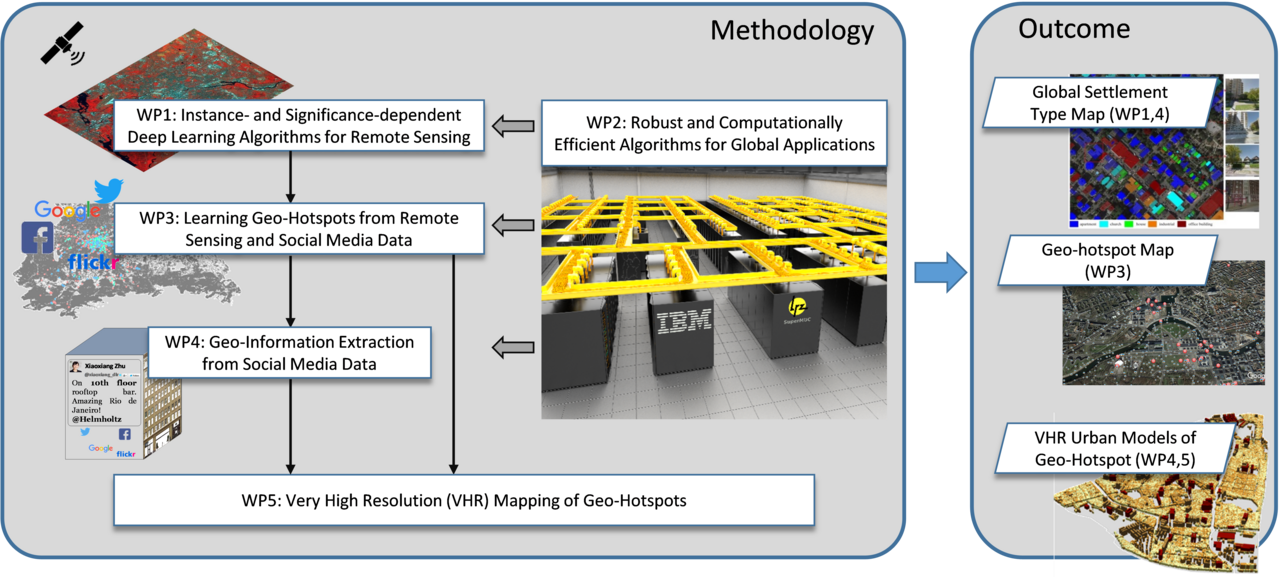
This project aims at jointly exploiting big data from social media and satellite observations for urban science. Two major strategies will be pursued:
1) Urban mapping on a global scale: The focus is to extract highly relevant geo-information from social media data (images and texts) and existing global EO data sets (SAR, multi-/super-/hyperspectral), in order to boost urban geographic research. Information of interest includes 3D/4D urban models, building settlement types and the distribution of tourist attractions, properties, public services etc. For this strategy, robust and computationally efficient retrieval and machine learning algorithms will be promoted.
2) Urban mapping in very high resolution: Advanced sensor and mission concepts aim at higher resolution or/and larger spatial or temporal coverage. Both trends will eventually converge to very high resolution datasets on a global scale. To be prepared for the future urban EO capabilities, the focus here is to exploit very high resolution data in selected cities and to improve the information retrieval from them to the ultimate extent. Particular focus will be put on explorative signal processing concepts and novel machine learning methods, e.g. deep learning algorithms.