Alpine remote sensing of climate‐induced natural hazards
AlpSenseRely is the three-year follow-up project of the successful pilot study AlpSenseBench. The aim is to develop an early warning system for natural hazards in alpine areas that are particularly sensitive to climate change. The focus is on assessing the reliability of different sensors individually and in interaction. The analyses will ultimately be used to derive meaningful indicators for early detection and a comprehensive monitoring concept that can also be transferred to other climate-induced hotspots.
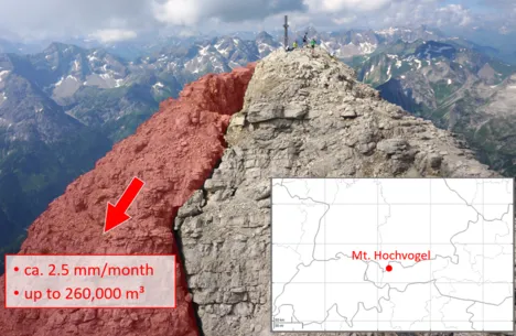
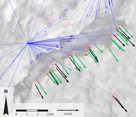
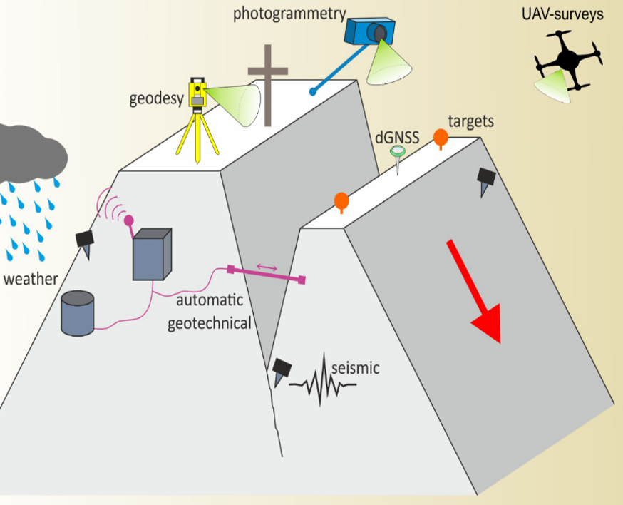
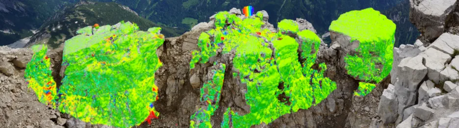
Within the project, the Chair of Engineering Geodesy is responsible for the engineering geodetic monitoring of special hazard hotspots, such as Mt. Hochvogel (2592 m). The alpine measurement environment puts new demands on the monitoring system and the methods of deformation analysis. Specifically, research is being conducted on a method of rigorous deformation analysis based on point clouds without the need for signalized target points. Terrestrial Laser Scanning (TLS) can capture point clouds over the entire object with high accuracy. To date, evaluation has been limited to change detection. Real deformation vectors and information on the statistical significance of the detected movements cannot be derived due to the lack of identical points. A method under development at the chair solves this problem by retrieving prominent structures on rock faces using the Iterative Closest Point (ICP) algorithm, thus allowing identical points to be included in the rigorous deformation analysis. This can significantly increase the spatial resolution of high-precision 3D deformation vectors, even for inaccessible areas.
More information about the project: AlpSenseRely
| Project | AlpSenseRely Alpine remote sensing of climate‐induced natural hazards |
| Duration | 2021-2023 |
| Coordinator | Prof. Dr. rer. nat. Michael Krautblatter Chair of Landslide Research |
| Collaborators | Lukas Raffl, M.Sc. Prof. Dr.-Ing Christoph Holst |
| Scientific partners | TUM Chair of Landslide Research TUM Chair of Engineering Geodesy TUM Photogrammetry and Remote Sensing LMU Geology Bayerische Akademie der Wissenschaften BAdW, Geodesy and Glaciology FAU Erlangen University of Vienna |
| SME-Partners | GEORESEARCH Forschungsgesellschaft GmbH 3D RealityMaps GmbH, 3DRM Happy Monitoring GmbH |
| Financing: | Bavarian State Ministry of the Environment and Consumer Protection |