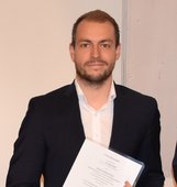
Christof Beil, M.Sc.

E-Mail: christof.beil@tum.de
Telefon: +49.89.289.22579
Raum: 0772  
Twitter:

@christofbeil

Anschrift: Technische Universität München
Christof Beil
Lehrstuhl für Geoinformatik
Arcisstraße 21
80333 München
Sprechzeiten: Nach Vereinbarung per E-Mail

Forschung

  • CityGML und 3D-Stadtmodelle
  • Straßenraummodellierung

Lehre

ITBE Fusion Lab

Wintersemester 2023/24

Geospatial Information Science

Wintersemester 2022/23

Übungen zu Geoinformatik

Sommersemester 2021, 2022, 2023

Übung zu Geoinformatik 1

Sommersemester 2017, 2020

Übung zu Geoinformatik 2

Wintersemester 2019/20, 2020/21

Selected GIS-Projects

Wintersemester 2020/21, 2021/22, 2022/23, 2023/24

Applied GIS

Wintersemester 2020/21, 2021/22

GIS for Transportation Systems

Wintersemester 2020/21

Projekte

2017 3D City Model of New York City

2021-2023 PLIMOS: Planung intermodaler Mobilitätsangebote basierend auf 3D-Stadtmodellen

2021-2023 wissenschafltiche Begleitung des Projekts Digitaler Zwilling München

2021-2023 SaveNoW - Funktions- und Verkehrs-Sicherheit für Automatisierte und Vernetzte Mobilität – Nutzen für die Gesellschaft und oekologische Wirkung

2022-2024 Standardisierung: Digitaler Zwilling für Städte und Kommunen (DIN SPEC 91607)

Vorträge

  • 10. Workshop 3D-Stadtmodelle - 12.11.2018 in Bonn - Detaillierte Repräsentation des Straßenraums in 3D-Stadtmodellen

  • 15. 3DGeoInfo Conference – 09.09.2020 – Combined Modelling of multiple Transportation Infrastructure within City Models

  • Leonhard Obermeyer Center (LOC) Day – 30.10.2020 – Digital Streetspace Modelling for autonomous Driving and more

  • Münchner GI Runde – 24.03.2021 - Detaillierte 3D-Straßenraummodellierung für multimodale Verkehrssimulationen und weitere Anwendungen

  • 16. 3DGeoInfo Conference – 13.10.2021 – Integration of 3D point clouds with semantic 3D city models - Providing semantic information beyond classification

  • 12. Workshop 3D-Stadtmodelle - 10.11.2021 (Online) - Detaillierte 3D-Straßenraummodellierung mit CityGML 3.0 - Beispiele und Anwendungen

  • 17. 3DGeoInfo Conference – 19.10.2022 – Dynamic and Web-based 4D Visualization of Streetspace Activities Derived from Traffic Simulations and Semantic 3D City Models

  • Münchner GI Runde – 21.03.2023 - Die Erschließung des Straßenraums für 3D-Stadtmodelle

  • digitalBAU conference & networking - 04.07.2023 - 3D-Stadtmodllierung und die Erschließung des Straßenraums

  • 18. 3DGeoInfo Conference – 13.09.2023 – Automatically evaluating the service quality of bicycle paths based on semantic 3D city models

Publikationen

2024

  • Kolbe, Thomas H.; Donaubauer, Andreas; Beil, Christof (Hrsg.): Recent Advances in 3D Geoinformation Science – Proceedings of the 18th 3D GeoInfo Conference. Lecture Notes in Geoinformation and Cartography. Springer, 2024 mehr… BibTeX
  • Olbrich, Felix; Beil, Christof; Nguyen, Son H.; Kolbe, Thomas H.: Multimodale Navigationsanwendungen für CityGML 3.0-konforme 3D-Straßenraummodelle mittels Graphdatenbanken. 44. Wissenschaftlich-Technische Jahrestagung der DGPF in Remagen – Publikationen der DGPF, Deutsche Gesellschaft für Photogrammetrie, Fernerkundung und Geoinformation e.V., 2024, 357-369 mehr… BibTeX

2023

  • Amini, Sasan; Orlich, Christoph; Beil, Christof; Keler, Andreas; Bogenberger, Klaus: Integrating SUMO in an urban digital twin - a case study from Munich. SUMO User Conference 2023, 2023 mehr… BibTeX
  • Beil, Christof; Donaubauer, Andreas; Kutzner, Tatjana; Hartmann, Jonas; Ilse, Henrike; Kraus, Anja; Rott, Matthias; Weigenthaler, Verena; Wrabel, Tamira: Drohnen, Digitale Zwillinge und Clouds in der Cloud – Die Trendanalyse zur INTERGEO 2022. zfv - Zeitschrift für Geodäsie, Geoinformation und Landmanagement (1), 2023, 75-92 mehr… BibTeX
  • Beil, Christof; Ilic, Mario; Keler, Andreas; Kolbe, Thomas H.: Automatically evaluating the service quality of bicycle paths based on semantic 3D city models. Lecture Notes in Geoinformation and Cartography - Recent Advances in 3D Geoinformation Science - Proceedings of the 18th 3D GeoInfo Conference, 2023 mehr… BibTeX

2022

  • Beil, Christof; Kendir, Murat; Ruhdorfer, Roland; Kolbe, Thomas H.: Dynamic and web-based 4D visualization of streetspace activities derived from traffic simulations and semantic 3D city models. Proceedings of the 17th International 3D GeoInfo Conference 2022 , 2022 mehr… BibTeX

2021

  • Beil, Christof; Kutzner, Tatjana; Schwab, Benedikt; Willenborg, Bruno; Gawronski, Alexander; Kolbe, Thomas H.: Integration of 3D point clouds with semantic 3D city models – Providing semantic information beyond classification. Proceedings of the 16th International 3D GeoInfo Conference 2021 ( ISPRS Annals of the Photogrammetry, Remote Sensing and Spatial Information Sciences ), 2021, 105--112 mehr… BibTeX
  • Beil, Christof; Dimitrov, Hristiyan; Dong, Zeyu; Kavelj, Nikola; Khalil, Carine; Kutzner, Tatjana; Müller, Felix; Nguyen, Son H.; Wysocki, Olaf: INTERGEO DIGITAL 2020 - Trendanalyse. zfv - Zeitschrift für Geodäsie, Geoinformation und Landmanagement 146 (1), 2021, 64-70 mehr… BibTeX
  • Beil, Christof; Dimitrov, Hristiyan; Dong, Zeyu; Kavelj, Nikola; Khalil, Carine; Kutzner, Tatjana; Müller, Felix; Nguyen, Son H.; Wysocki, Olaf: Trendanalyse Intergeo Digital 2020. gis.Business (1), 2021, 46-49 mehr… BibTeX
  • Beil, Christof; Knezevic, Marija; Schwab, Benedikt; Wysocki, Olaf; Abdelhamid, Mohamed; Bajramovic, Vedran; Subbaraman, Somakala: Trendanalyse Intergeo 2021. gis.Business (6), 2021 mehr… BibTeX
  • Beil, Christof; Kutzner, Tatjana: Stadtplanung: Digitale Zwillinge für smartere Städte. Der Gemeinderat, 2021 mehr… BibTeX

2020

  • Beil, Christof; Kolbe, Thomas H.: Combined modelling of multiple transportation infrastructure within 3D city models and its implementation in CityGML 3.0. Proceedings of the 15th International 3D GeoInfo Conference 2020 ( ISPRS Annals of the Photogrammetry, Remote Sensing and Spatial Information Sciences ), ISPRS , 2020 mehr… BibTeX
  • Beil, Christof; Ruhdorfer, Roland; Coduro, Theresa; Kolbe, Thomas H.: Detailed Streetspace Modelling for Multiple Applications: Discussions on the Proposed CityGML 3.0 Transportation Model. ISPRS International Journal of Geo-Information 9 (10), 2020, 603 mehr… BibTeX
  • Schwab, Benedikt; Beil, Christof; Kolbe Thomas H.: Spatio-Semantic Road Space Modeling for Vehicle–Pedestrian Simulation to Test Automated Driving Systems. Sustainability 12 (9), 2020, 3799 mehr… BibTeX

2018

  • Beil, Christof; Kolbe, Thomas H.: Detaillierte Repräsentation des Straßenraums in 3D Stadtmodellen. PFGK18 - Photogrammetrie - Fernerkundung - Geoinformatik - Kartographie, 37. Jahrestagung in München 2018 (Publikationen der Deutschen Gesellschaft für Photogrammetrie, Fernerkundung und Geoinformation (DGPF) e.V. 27), Deutsche Gesellschaft für Photogrammetrie, Fernerkundung und Geoinformation e.V., 2018, 717-728 mehr… BibTeX

2017

  • Beil, Christof: Detaillierte Repräsentation des Straßenraums in 3D-Stadtmodellen. Masterarbeit, 2017 mehr… BibTeX
  • Beil, Christof; Kolbe, Thomas H.: CityGML and the streets of New York - A proposal for detailed street space modelling. Proceedings of the 12th International 3D GeoInfo Conference 2017 (ISPRS Annals of the Photogrammetry, Remote Sensing and Spatial Information Sciences), ISPRS, 2017, 9-16 mehr… BibTeX
  • Willenborg, Bruno; Marx, Caroline; Beil, Christof; Erbe, Karin; Heinze, Kristina; Ionescu, Andrei; Podhorsky, Felix; Schönhut, Sabine; Steudel, Maximilian: Trendanalyse InterGEO 2017. zfv - Zeitschrift für Geodäsie, Geoinformation und Landmanagement 142 (6), 2017 mehr… BibTeX