
- The EuroCropsML time series benchmark dataset for few-shot crop type classification in Europe. Scientific Data 12 (1), 2025 mehr…
- Advancing Transnational Assessments of Biodiversity Drivers in European Agriculture with an Updated Hierarchical Crop and Agriculture Taxonomy (HCAT). npj Sustainable Agriculture 3, 2025 mehr…
- Self-Attention and Frequency-Augmentation for Unsupervised Domain Adaptation in Satellite Image-based Time Series Classification. ISPRS Journal of Photogrammetry and Remote Sensing (P&RS), 2025 mehr…
- Boosting crop classification by hierarchically fusing satellite, rotational, and contextual data. Remote Sensing of Environment 305, 2024 mehr…
- Approaching Holistic Crop Type Mapping in Europe through Winter Vegetation Classification and the Hierarchical Crop and Agriculture Taxonomy. International Journal of Applied Earth Observation and Geoinformation 134, 2024, 1--16 mehr…
- Sentinel-2 Tiling Scheme Grid-Overlay for Efficient I/O-Operations Based on Spherical Voronoi Polygons and Local Optimization. IEEE International Geoscience and Remote Sensing Symposium (IGARSS), 2024 mehr…
- Deep learning based differentiable/hybrid modelling of the global hydrological cycle. EGU General Assembly, Copernicus GmbH, 2024 mehr…
- Hybrid-Modeling of Land-Atmosphere Fluxes Using Integrated Machine Learning in the ICON-ESM Modeling Framework. EGU General Assembly, Copernicus GmbH, 2024 mehr…
- Data on Demand: Automatic Generation of Customized Datasets for the Training of Building Detection in Remote Sensing Imagery. IEEE International Geoscience and Remote Sensing Symposium (IGARSS), 2024 mehr…
- Knowledge Distillation from Big Administrative Data. EO for Agriculture Under Pressure Workshop, 2024 mehr…
- Multiresolution Analysis-based Assessment of Agricultural Effects on Groundwater Levels. EO for Agriculture Under Pressure Workshop, 2024 mehr…
- EuroCrops: The Largest Harmonized Open Crop Dataset Across the European Union. Nature Scientific Data 10 (1), 2023 mehr…
- Hybrid modeling of evapotranspiration: inferring stomatal and aerodynamic resistances using combined physics-based and machine learning. Environmental Research Letters 18 (3), 2023, 034039 mehr…
- Geodata Discoverabiltity. , Hrsg.: European Spatial Data Research (EuroSDR), 2023, mehr…
- Generalization Across Sensor-Modalities for Deforestation Assessment. IGARSS 2023 - 2023 IEEE International Geoscience and Remote Sensing Symposium, 2023 mehr…
- XAI for Early Crop Classification. IEEE International Geoscience and Remote Sensing Symposium (IGARSS), 2023 mehr…
- Fully Automatic Generation of Training Data For Building Detection and Classification from Remote Sensing Imagery. IEEE International Geoscience and Remote Sensing Symposium (IGARSS), 2023 mehr…
- Prediction of multi-year winter wheat yields at the field level with satellite and climatological data. Computers and Electronics in Agriculture 194, 2022, 106777 mehr…
- Towards hybrid modeling of the global hydrological cycle. Hydrology and Earth System Sciences 26 (6), 2022, 1579-1614 mehr…
- Sequential Models for Endoluminal Image Classification. Diagnostics 12 (2), 2022 mehr…
- Harnessing Administrative Data Inventories to Create a Reliable Transnational Reference Database for Crop Type Monitoring. IEEE International Geoscience and Remote Sensing Symposium (IGARSS), IEEE, 2022 mehr…
- Challenges and Opportunities of Large Transnational Datasets: A Case Study on European Administrative Crop Data. Workshop on Broadening Research Collaborations, 2022Advances in Neural Information Processing Systems (NeurIPS) mehr…
- Derivation of Geometrically and Semantically Annotated UAV Datasets at Large Scales from 3D City Models. International Conference on Pattern Recognition (ICPR), IEEE, 2021 mehr…
- [Re] Satellite Image Time Series Classification with Pixel-Set Encoders and Temporal Self-Attention. ReScience C 7 (2), 2021 mehr…
- EuroCrops: A Pan-European Dataset for Time Series Crop Type Classification. Proceedings of the 2021 Conference on Big Data from Space (BiDS '21), Publications Office of the European Union, 2021, 125-128 mehr…
- Building segmentation through a gated graph convolutional neural network with deep structured feature embedding. ISPRS Journal of Photogrammetry and Remote Sensing 159, 2020, 184-197 mehr…
- Self-attention for raw optical Satellite Time Series Classification. ISPRS Journal of Photogrammetry and Remote Sensing 169, 2020, 421-435 mehr…
- So2Sat LCZ42: A Benchmark Data Set for the Classification of Global Local Climate Zones [Software and Data Sets]. IEEE Geoscience and Remote Sensing Magazine 8 (3), 2020, 76-89 mehr…
- Building Footprint Generation by Integrating Convolution Neural Network With Feature Pairwise Conditional Random Field (FPCRF). IEEE Transactions on Geoscience and Remote Sensing 58 (11), 2020, 7502-7519 mehr…
- SAR Tomography at the Limit: Building Height Reconstruction Using Only 3–5 TanDEM-X Bistatic Interferograms. IEEE Transactions on Geoscience and Remote Sensing 58 (11), 2020, 8026-8037 mehr…
- KI-basierte Detektion von Gebäuden mittels Deep Learning und amtlichen Geodaten zur Baufallerkundung. zfv – Zeitschrift für Geodäsie, Geoinformation und Landmanagement (3/2020), 2020, 180-189 mehr…
- Detection of Undocumented Building Constructions from Official Geodata Using a Convolutional Neural Network. Remote Sensing 12 (21), 2020, 3537 mehr…
- A multi-axis differential optical absorption spectroscopy aerosol profile retrieval algorithm for high-altitude measurements: application to measurements at Schneefernerhaus (UFS), Germany. Atmospheric Measurement Techniques 13 (4), 2020, 1835-1866 mehr…
- An improved air mass factor calculation for nitrogen dioxide measurements from the Global Ozone Monitoring Experiment-2 (GOME-2). Atmospheric Measurement Techniques 13 (2), 2020, 755-787 mehr…
- Applying FP_ILM to the retrieval of geometry-dependent effective Lambertian equivalent reflectivity (GE_LER) daily maps from UVN satellite measurements. Atmospheric Measurement Techniques 13 (2), 2020, 985-999 mehr…
- DETECTION OF UNDOCUMENTED BUILDINGS USING CONVOLUTIONAL NEURAL NETWORK AND OFFICIAL GEODATA. ISPRS Annals of Photogrammetry, Remote Sensing and Spatial Information Sciences V-2-2020, 2020, 517-524 mehr…
- BREIZHCROPS: A TIME SERIES DATASET FOR CROP TYPE MAPPING. ISPRS - International Archives of the Photogrammetry, Remote Sensing and Spatial Information Sciences XLIII-B2-2020, 2020, 1545-1551 mehr…
- LONG-SHORT SKIP CONNECTIONS IN DEEP NEURAL NETWORKS FOR DSM REFINEMENT. ISPRS - International Archives of the Photogrammetry, Remote Sensing and Spatial Information Sciences XLIII-B2-2020, 2020, 383-390 mehr…
- Comparison of monocular depth estimation methods using geometrically relevant metrics on the IBims-1 dataset. Computer Vision and Image Understanding (CVIU) 191, 2020, 102877 mehr…
- A generalized multi-task learning approach to stereo DSM filtering in urban areas. ISPRS Journal of Photogrammetry and Remote Sensing 166, 2020, 213-227 mehr…
- Multitask Learning for Human Settlement Extent Regression and Local Climate Zone Classification. IEEE Geoscience and Remote Sensing Letters, 2020, 1-5 mehr…
- The Importance of Loss Functions for Increasing the Generalization Abilities of a Deep Learning-Based Next Frame Prediction Model for Traffic Scenes. Machine Learning and Knowledge Extraction 2 (2), 2020, 78-98 mehr…
- HYBRID MODELING: FUSION OF A DEEP LEARNING APPROACH AND A PHYSICS-BASED MODEL FOR GLOBAL HYDROLOGICAL MODELING. ISPRS - International Archives of the Photogrammetry, Remote Sensing and Spatial Information Sciences XLIII-B2-2020, 2020, 1537-1544 mehr…
- FGCN: Deep Feature-based Graph Convolutional Network for Semantic Segmentation of Urban 3D Point Clouds. 2020 IEEE/CVF Conference on Computer Vision and Pattern Recognition Workshops (CVPRW), IEEE, 2020 mehr…
- First Experiences with Active C-Band Radar Reflectors and Sentinel-1. IGARSS 2020 - 2020 IEEE International Geoscience and Remote Sensing Symposium, IEEE, 2020 mehr…
- Generation of Large-Scale High Quality 3-D Urban Models*Note: Sub-titles are not captured in Xplore and should not be used. 2020 IEEE Radar Conference (RadarConf20), IEEE, 2020 mehr…
- Meta-Learning for Few-Shot Land Cover Classification. IEEE/CVF Conference on Computer Vision and Pattern Recognition Workshops (CVPRW), 2020 mehr…
- Model and Data Uncertainty for Satellite Time Series Forecasting with Deep Recurrent Models. IGARSS 2020 - 2020 IEEE International Geoscience and Remote Sensing Symposium, IEEE, 2020 mehr…
- Meta-Learning For Few-Shot Time Series Classification. IEEE International Geoscience and Remote Sensing Symposium (IGARSS), 2020 mehr…
- Towards global hybrid hydrological modeling by fusing deep learning and a conceptual model. EGU General Assembly, 2020 mehr…
- Identifying Dynamic Memory Effects on Vegetation State Using Recurrent Neural Networks. Frontiers in Big Data 2, 2019 mehr…
- Multi-Task cGAN for Simultaneous Spaceborne DSM Refinement and Roof-Type Classification. Remote Sensing 11 (11), 2019, 1262 mehr…
- Automatic and Semantically-Aware 3D UAV Flight Planning for Image-Based 3D Reconstruction. Remote Sensing 11 (13), 2019 mehr…
- Monocular-Depth Assisted Semi-Global-Matching. International Annals of the Photogrammetry, Remote Sensing and Spatial Information Sciences (ISPRS) IV-2/W7, 2019, 55-62 mehr…
- FutureGAN: Anticipating the Future Frames of Video Sequences using Spatio-Temporal 3d Convolutions in Progressively Growing GANs. The International Archives of the Photogrammetry, Remote Sensing and Spatial Information Sciences (ISPRS) XLII-2/W16, 2019, 3-11 mehr…
- Learning Likelihoods with Conditional Normalizing Flows. University of Amsterdam, 2019, mehr…
- Evaluation of CNN-Based Single-Image Depth Estimation Methods. Proceedings of the European Conference on Computer Vision Workshops (ECCV-WS), Springer International Publishing, 2019, 331-348 mehr…
- Enhancing Traffic Scene Predictions with Generative Adversarial Networks. IEEE Intelligent Transportation Systems Conference (ITSC), 2019, 1768-1775 mehr…
- MultiDepth: Single-Image Depth Estimation via Multi-Task Regression and Classification. IEEE Intelligent Transportation Systems Conference (ITSC), IEEE, 2019, 1440-1447 mehr…
- End-to-end Learning for Early Classification of Time Series. arXiv preprint arXiv:1901.10681, 2019 mehr…
- Towards Multi-class Object Detection in Unconstrained Remote Sensing Imagery. arXiv preprint arXiv:1807.02700, 2018 mehr…
- Aerial LaneNet: Lane Marking Semantic Segmentation in Aerial Imagery using Wavelet-Enhanced Cost-sensitive Symmetric Fully Convolutional Neural Networks. IEEE Transactions on Geoscience and Remote Sensing, 2018 mehr…
- Multi-Temporal Land Cover Classification with Sequential Recurrent Encoders. ISPRS International Journal of Geo-Information 7 (4), 2018, 129 mehr…
- Auxiliary Tasks in Multi-task Learning. arXiv preprint arXiv:1805.06334, 2018 mehr…
- Building instance classification using street view images. ISPRS Journal of Photogrammetry and Remote Sensing, 2018 mehr…
- Building Footprint Extraction From VHR Remote Sensing Images Combined With Normalized DSMs Using Fused Fully Convolutional Networks. IEEE Journal of Selected Topics in Applied Earth Observations and Remote Sensing (JSTAR) 11, 2018, 2615-2629 mehr…
- The Operational Cloud Retrieval Algorithms from TROPOMI on board Sentinel-5 Precursor. Atmospheric Measurement Techniques 11 (1), 2018, 409--427 mehr…
- AUTOMATIC LARGE-SCALE 3D BUILDING SHAPE REFINEMENT USING CONDITIONAL GENERATIVE ADVERSARIAL NETWORKS. International Archives of the Photogrammetry, Remote Sensing and Spatial Information Sciences (ISPRS) XLII-2, 2018, 103--108 mehr…
- COLORIZING SENTINEL-1 SAR IMAGES USING A VARIATIONAL AUTOENCODER CONDITIONED ON SENTINEL-2 IMAGERY. ISPRS - International Archives of the Photogrammetry, Remote Sensing and Spatial Information Sciences XLII-2, 2018, 1045--1051 mehr…
- Convolutional LSTMs for Cloud-Robust Segmentation of Remote Sensing Imagery. Proceedings of the Conference on Neural Information Processing Systems Workshops (NeurIPSW), 2018 mehr…
- Generation of Ground Truth Datasets for the Analysis of 3D Point Clouds in Urban Scenes Acquired via Different Sensors. International Archives of the Photogrammetry, Remote Sensing and Spatial Information Sciences (ISPRS) XLII-3, 2018, 2009-2015 mehr…
- Non-Local Compressive Sensing Based SAR Tomography. IEEE Transactions on Geoscience and Remote Sensing, 2018 mehr…
- DSM-to-LoD2: Spaceborne Stereo Digital Surface Model Refinement. Remote Sensing 10 (12), 2018 mehr…
- Automatic Large-Scale 3D Building Shape Refinement Using Conditional Generative Adversarial Networks. Proceedings of the IEEE Conference on Computer Vision and Pattern Recognition Workshops, 2018 mehr…
- Building Footprint Generation using Improved Generative Adversarial Networks. IEEE Geoscience and Remote Sensing Letters, 2018 mehr…
- Potential and Limits of Non-local Means InSAR Filtering for TanDEM-X High-resolution DEM Generation. Remote Sensing of Environment, 2018 mehr…
- Spaceborne Staring Spotlight SAR Tomography-A First Demonstration with TerraSAR-X. IEEE Journal of Selected Topics in Applied Earth Observations and Remote Sensing, 2018 mehr…
- A fast and accurate basis pursuit denoising algorithm with application to super-resolving tomographic SAR. IEEE Transactions on Geoscience and Remote Sensing, 2018 mehr…
- SAR Tomography using Non-Local Sparse Reconstruction. IGARSS 2018, 2018 mehr…
- Towards Global 3D/4D Urban Modeling Using TanDEM-X Data. EUSAR 2018, 2018 mehr…
- Towards high-resolution global urban 3D model from TanDEM-X data. 5th Joint Workshop Urban Remote Sensing {--} Challenges & Solutions, 2018 mehr…
- 3D reconstruction from very small TanDEM-X stacks. EUSAR 2018, 2018 mehr…
- An efficient algorithm for compressive sensing based SAR tomography. EUSAR 2018, VDE Verlag, 2018 mehr…
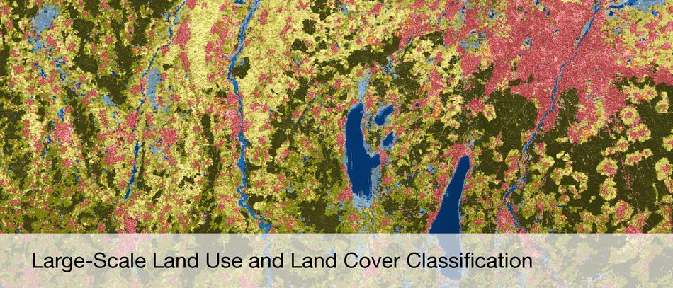
- Deep Convolutional Neural Networks for Semantic Segmentation of Multispectral Sentinel-2 Satellite Imagery: An Open Data Approach to Large-Scale Land Use and Land Cover Classification. 2017 mehr…
- Automatic UAV Image Geo-Registration by Matching UAV Images to Georeferenced Image Data. Remote Sensing 9 (4), 2017 mehr…
- Envilab: Measuring phytoplankton in-vivo absorption and scattering properties under tunable environmental conditions. Opt. Express 25 (21), 2017, 25267--25277 mehr…
- Sequential Estimator: Toward Efficient InSAR Time Series Analysis. IEEE Transactions on Geoscience and Remote Sensing 55 (10), 2017, 5637--5652 mehr…
- Multitemporal Crop Identification from Medium-Resolution Multi-Spectral Satellite Images based on Long Short-Term Memory Neural Networks. International Archives of the Photogrammetry, Remote Sensing and Spatial Information Sciences (ISPRS) XLII-1/W1, 2017, 551--558 mehr…
- Robust Object-Based Multipass InSAR Deformation Reconstruction. IEEE Transactions on Geoscience and Remote Sensing (TGRS) 8 (55), 2017, 4239--4251 mehr…
- Towards Seamless Validation of Land Cover Data. International Cartographic Conference, 2017 mehr…
- Improve Multi-baseline InSAR Parameter Retrieval by Semantic Information from Optical Images. IEEE International Geoscience and Remote Sensing Symposium (IGARSS), 2017 mehr…
- Robust Object-based Multi-Baseline InSAR. Advances in the Science and Applications of SAR Interferometry and Sentinel-1 InSAR (FRINGE), 2017 mehr…
- Temporal Vegetation Modelling using Long Short-Term Memory Networks for Crop Identification from Medium-Resolution Multi-Spectral Satellite Images. Proceedings of the IEEE Conference on Computer Vision and Pattern Recognition (CVPR) Workshops, 2017 mehr…
- Sequential Estimator- A Proposal for High-Precision and Efficient Earth Deformation Monitoring with InSAR. Fringe 2017, 2017 mehr…
- Efficient InSAR Time Series Analysis in the Era of Big Data. Helmholtz Alliance: Remote Sensing and Earth System Dynamics - 5th Alliance Week, 2017 mehr…
- High-Resolution DEM generation by nonlocal filtering of TanDEM-X interferograms. Fringe 2017, 2017 mehr…
- Towards Absolute Positioning of InSAR Point Clouds. FRINGE 2017, 2017 mehr…
- Sequential Estimator: a Novel Approach for Efficient High-Precision Analysis of Interferometric Time Series. IGARSS 2017, 2017 mehr…
- Nonlocal InSAR filtering for high resolution DEM generation from TanDEM-X interferograms. IGARSS 2017, 2017 mehr…
- Automatic Positioning of SAR Ground Control Points from Multi-Aspect TerraSAR-X Acquisitions. IEEE International Geoscience and Remote Sensing Symposium (IGARSS) 2017, IEEE Xplore, 2017 mehr…
- SAR Ground Control Point Identification with the Aid of High Resolution Optical Data. Proceedings of the International Geoscience and Remote Sensing Symposium (IGARSS), 2016, 3205--3208 mehr…
- Three-Dimensonal Deformation Monitoring of Urban Infrastructure by Tomographic SAR Using Multitrack TerraSAR-X Data Stacks. IEEE Transactions on Geoscience and Remote Sensing 54 (12), 2016, 6868--6878 mehr…
- IMOTOX - Identification and Monitoring of Toxic Cyanobacteria. IGSSE Water Focus Area, 2016 mehr…
- Sequential Estimator for Distributed Scatterer Interferometry. Proceedings of the International Geoscience and Remote Sensing Symposium (IGARSS), 2016, 6859--6862 mehr…
- Exploiting Joint Sparsity for Pansharpening: The J-SparseFI Algorithm. IEEE Transactions on Geoscience and Remote Sensing 54 (5), 2016, 2664-2681 mehr…
- A new Paradigm for Matching UAV and Aerial Images. International Annals of the Photogrammetry, Remote Sensing and Spatial Information Sciences (ISPRS) 3, 2016, 83--90 mehr…
- Nonlocal InSAR Filtering for DEM Generation and Addressing the Staircasing Effect. Proceedings of the 11th European Conference on Synthetic Aperture Radar (EUSAR), 2016, 1-4 mehr…
- Temporal monitoring of subglacial volcanoes with TanDEM-X -- Application to the 2014?2015 eruption within the Bárdharbunga volcanic system, Iceland. Remote Sensing of Environment 181, 2016, 186--197 mehr…
- Towards Single-Pixel FMCW Radar Reconstruction. Proceedings of the 4th International Workshop on Compressed Sensing Theory and its Applications to Radar, Sonar and Remote Sensing (CoSeRa), 2016, 95-99 mehr…
- Water Constituents and Water Depth Retrieval from Sentinel-2A—A First Evaluation in an Oligotrophic Lake. Remote Sensing 8 (11), 2016 mehr…
- Grenzen der Vermessung der Erde aus dem All mit Synthetischem Apertur Radar. In: Photogrammetrie und Fernerkundung: Handbuch der Geodäsie. Springer Berlin Heidelberg, 2016, 1--42 mehr…
- Geodetic SAR tomography. IEEE Transactions on Geoscience and Remote Sensing 54 (1), 2016, 18--35 mehr…
- Toward Operational Compensation of Ionospheric Effects in SAR Interferograms: The Split-Spectrum Method. IEEE Transactions on Geoscience and Remote Sensing 54 (3), 2016, 1446--1461 mehr…
- Interferometric Processing of Sentinel-1 TOPS Data. IEEE Transactions on Geoscience and Remote Sensing 54 (04), 2016, 2220--2234 mehr…
- RaySAR - 3D SAR Simulator: Now Open Source. Proceedings of the International Geoscience and Remote Sensing Symposium (IGARSS), 2016, 6730--6733 mehr…
- Single-Image Super Resolution for Multispectral Remote Sensing Data Using Convolutional Neural Networks. International Archives of the Photogrammetry, Remote Sensing and Spatial Information Sciences (ISPRS) XLI-B3, 2016, 883--890 mehr…
- Automatic Alignment of Indoor and Outdoor Building Models using 3D Line Segments. Proceedings of the IEEE Conference on Computer Vision and Pattern Recognition Workshops, 2016 mehr…
- The TUM-DLR Multimodal Earth Observation Evaluation Benchmark. The IEEE Conference on Computer Vision and Pattern Recognition (CVPR) Workshops, 2016 mehr…
- Object-based InSAR deformation reconstruction with application to bridge monitoring. IEEE International Geoscience and Remote Sensing Symposium (IGARSS), 2016 mehr…
- Automatic Detection and Reconstruction of 2D/3D Building Shapes from Spaceborne TomoSAR Point Clouds. Transactions on Geoscience and Remote Sensing, 2015 mehr…
- InSAR Forensics: Tracing InSAR Scatterers in High Resolution Optical Image. Proceedings of FRINGE Workshop, 2015 mehr…
- Hyperspectral Resolution Enhancement – Application To Real Image Pair. Proceedings of the 7th Workshop on Hyperspectral Image and Signal Processing: Evolution in Remote Sensing (WHISPERS), 2015 mehr…
- Reconstruction of Building Footprints Using Spaceborne TomoSAR Point Clouds. Annals of Photogrammetry, Remote Sensing and Spatial Information Sciences (ISPRS), 2015 mehr…
- Graph Regularized Coupled Spectral Unmixing for Change Detection. Proceedings of the 7th Workshop on Hyperspectral Image and Signal Processing: Evolution in Remote Sensing (WHISPERS), 2015 mehr…
- Semantic Interpretation of InSAR Estimates Using Optical Images with Application to Urban Infrastructure Monitoring. The International Archives of Photogrammetry, Remote Sensing and Spatial Information Sciences (ISPRS), 2015 mehr…
- Characterization of Facade Regularities in High-Resolution SAR Images. Transactions on IEEE Geoscience and Remote Sensing 53 (5), 2015, 2727--2737 mehr…
- Möglichkeiten der Erzeugung Städtischer Oberflächenmodelle mit Interferometrischer SAR-Fernerkundung. gis. SCIENCE 2, 2015 mehr…
- Three-dimensional Reconstruction of Urban Areas by Multi-Aspect TomoSAR Data Fusion. Proceedings of Joint Urban Remote Sensing Event (JURSE), 2015, 1--4 mehr…
- Interferometric Processing of Sentinel-1 TOPS Data. Transactions on Geoscience and Remote Sensing, 2015 mehr…
- Grenzen der Vermessung der Erde aus dem All mit Synthetischem Apertur Radar, in: Handbuch der Geodäsie. Photogrammetrie und Fernerkundung. Springer-Verlag (Heipke C. (Hrsg.). Aufl.), 2015 mehr…
- Absorption and Fluorescence Characteristics of Colored Dissolved Matter for Remote Sensing: A Case Study on CDOM in Pre-alpine Lakes. International Workshop on Organic Matter Spectroscopy, 2015 mehr…
- Exploiting Group Sparsity in SAR Tomography. Proceedings of the 3rd International Workshop on Compressed Sensing Theory and its Applications to Radar, Sonar and Remote Sensing (CoSeRa), 2015 mehr…
- Sparse Reconstruction Automaton for Synthetic Aperture Radar Tomography. European Radar Conference, 2015 mehr…
- Automatic Feature-based Geometric Fusion of Multi-view TomoSAR Point Clouds in Urban Area. IEEE Journal of Selected Topics in Applied Earth Observation and Remote Sensing 8 (3), 2015, 953 -- 965 mehr…
- Detection of Buildings in Spaceborne TomoSAR Point Clouds via Hybrid Region Growing and Energy Minimization Technique. Proceedings of Joint Urban Remote Sensing Event (JURSE), 2015 mehr…
- Non-Local Means Filter for Polarimetric Sar Speckle Reduction-Experiments Using TerraSAR-X Data. International Annals of the Photogrammetry, Remote Sensing and Spatial Information Sciences (ISPRS) {II}-3/W4, 2015 mehr…
- A Metric for Polygon Comparison and Building Extraction Evaluation. IEEE Geoscience and Remote Sensing Letters 12 (1), 2015, 170--174 mehr…
- Joint Sparsity and Endmember Preselection Concepts in Spectral Unmixing. Proceedings of the International Geoscience and Remote Sensing Symposium (IGARSS), 2015 mehr…
- SAR Tomography uing Staring and High-Resolution Spotlight Data from the TanDEM-X Pursuit Monostatic Mode. Proceedings of the International Geoscience and Remote Sensing Symposium (IGARSS), 2015 mehr…
- TerraSAR-X Stereo-Radargrammetric Forest DEM Generation. Proceedings of the International Geoscience and Remote Sensing Symposium (IGARSS), 2015 mehr…
- Automatic Coastline Detection in Non-locally Filtered TanDEM-X Data. Proceedings of the International Geoscience and Remote Sensing Symposium (IGARSS), 2015 mehr…
- Exploiting Sparsity in Remote Sensing and Earth Observation: Theory, Applications and Future Trends. Proceedings of the International Geoscience and Remote Sensing Symposium (IGARSS), 2015 mehr…
- Towards a Combined Sparse Representation and Unmixing Based Hyperspectral Resolution Enhancement Method. Proceedings of the International Geoscience and Remote Sensing Symposium (IGARSS), 2015, 1--4 mehr…
- Region Growing Based Nonlocal Filtering for InSAR. Proceedings of the International Geoscience and Remote Sensing Symposium (IGARSS), 2015 mehr…
- Semantic Interpretation of InSAR Point Cloud. Proceedings of the International Geoscience and Remote Sensing Symposium (IGARSS), 2015 mehr…
- Compressive Sensing for Neutrospheric Water Vapor Tomography from GNSS and InSAR Observations. Proceedings of the International Geoscience and Remote Sensing Symposium (IGARSS), 2015 mehr…
- Group Sparsity in SAR Tomography – Experiments on TanDEM-X data Stacks. International Radar Symposium, 2015 mehr…
- The Robust InSAR Optimization Framework with Application to Monitoring Cities on Volcanoes. Proceedings of Joint Urban Remote Sensing Event (JURSE), 2015 mehr…
- Robust Reconstruction of Building Facades for Large Areas Using Spaceborne TomoSAR Point Clouds. IEEE Transactions on Geoscience and Remote Sensing 53 (2), 2015, 752--769 mehr…
- Precise Three-Dimensional Stereo Localization of Corner Reflectors and Persistent Scatterers With TerraSAR-X. IEEE Transactions on Geoscience and Remote Sensing 53 (4), 2015, 1782--1802 mehr…
- Dictionary Learning Strategies for Sparse Representation Based Hyperspectral Image Enhancement. Proceedings of the 7th Workshop on Hyperspectral Image and Signal Processing: Evolution in Remote Sensing (WHISPERS), 2015 mehr…
- Splitting the Hyperspectral-Multispectral Image Fusion Problem into Weighted Pan-sharpening Problems - The Spectral Grouping Concept. Proceedings of the 7th Workshop on Hyperspectral Image and Signal Processing: Evolution in Remote Sensing (WHISPERS), 2015 mehr…
- Deformation Monitoring of Urban Infrastructure by Tomographic SAR Using Multi-View TerraSAR-X Data Stacks. Proceedings of FRINGE Workshop, 2015 mehr…
- Satellite InSAR Data - Reservoir Monitoring from Space [Book Reviews]. Geoscience and Remote Sensing Magazine 3 (1), 2015, 53--54 mehr…
- Geodetic SAR Tomography. Transactions on Geoscience and Remote Sensing 54 (1), 2015, 18--35 mehr…
- Toward Operational Compensation of Ionospheric Effects in SAR Interferograms: The Split-Spectrum Method. Transactions on Geoscience and Remote Sensing PP (99), 2015 mehr…
- Segmentation and Crown Parameter Extraction of Individual Trees in an Airborne TomoSAR Point Cloud. International Archives of the Photogrammetry, Remote Sensing and Spatial Information Sciences (ISPRS) {XL}-3/W2, 2015, 205--209 mehr…
- Die Vermessung der Stadt aus dem Orbit, in: Globale Urbanisierung: Perspektive aus dem All. Springer-Verlag (Taubenböck H. et al. (Hrsg.). Aufl.), 2015 mehr…
- Reconstruction of Individual Trees from Multi-Aspect TomoSAR Data. Remote Sensing of Environment 165, 2015, 175--185 mehr…
- TerraSAR-X, TanDEM-X and Beyond. International Archives of the Photogrammetry, Remote Sensing and Spatial Information Sciences (ISPRS) XL-3 (W2), 2015, 295--296 mehr…
- Development of new Multi-band Equatorially Orbiting POLinSAR Satellite Sensors System Configurations for Varying Latitudinal Coverage within Total Tropical Belt (Invited Group presentation for establishing an associated Consortium). Asian Pacific Conference on Synthetic Aperture Radar (APSAR), 2015, 1--4 mehr…
- Voluminator-Approximating the Volume of 3D Buildings to Overcome Topological Errors. In: AGILE 2015: Geographic Information Science as an Enabler of Smarter Cities and Communities. Springer International Publishing, 2015, 343-362 mehr…
- Regularized Geometric Hulls for Bio-medical Image Segmentation. Annals of the BMVA 2015 (5), 2015, 1--12 mehr…
- Methods for Model-based and Model-free Recognition of Articulated Actions in Multi-View Environments. Computer Science. Verlag Dr. Hut, 2015 mehr…
- Single Tree Recognition in Millimeterwave SAR Data by Morphological Attribute Filters. , 2014 mehr…
- Spectral-Spatial Joint Sparsity Unmixing of Hyperspectral Data using Overcomplete Dictionaries. Proceedings of the 6th Workshop on Hyperspectral Image and Signal Processing: Evolution in Remote Sensing (WHISPERS), 2014 mehr…
- Compressive Sensing for Super-resolving SAR Imaging to Support Target Detection in Coastal Zone. Proceedings of the 10th European Conference on Synthetic Aperture Radar (EUSAR), 2014, 1--4 mehr…
- Coregistration Refinement of Hyperspectral Images and DSM: An Object-based Approach using Spectral Information. Journal of Photogrammetry and Remote Sensing (ISPRS) 97, 2014, 1--8 mehr…
- Hyperspectral Image Resolution Enhancement Based on Jointly Sparse Spectral Unmixing. Proceedings of the International Geoscience and Remote Sensing Symposium (IGARSS), 2014 mehr…
- Persistent Scatterers at Building Facades - Evaluation of Appearance and Localization Accuracy. Journal of Photogrammetry and Remote Sensing (ISPRS) 100, 2014, 92--105 mehr…
- The J-SparseFI-HM Hyperspectral Resolution Enhancement Method – Now Fully Automated. Proceedings of the 6th Workshop on Hyperspectral Image and Signal Processing: Evolution in Remote Sensing (WHISPERS), 2014 mehr…
- Performance Assessment of the State-of-the-art Hyperspectral Image Enhancement Methods. Proceedings of the International Geoscience and Remote Sensing Symposium (IGARSS), 2014 mehr…
- High-Rise Building Feature Extraction using High Resolution Spotlight TanDEM-X Data. Proceedings of the 10th European Conference on Synthetic Aperture Radar (EUSAR), 2014, 1--4 mehr…
- Automatic Large Area Reconstruction of Building Façades from Spaceborne TomoSAR Point Clouds. Proceedings of the International Geoscience and Remote Sensing Symposium (IGARSS), 2014 mehr…
- Robust Covariance Matrix Estimation with Application to Volcano Monitoring using SAR Image Stacks. Proceedings of the 10th European Conference on Synthetic Aperture Radar (EUSAR), 2014, 1--4 mehr…
- Beyond the 12m TanDEM-X DEM. Proceedings of the International Geoscience and Remote Sensing Symposium (IGARSS), 2014 mehr…
- Exploiting Sparsity in Remote Sensing for Earth Observation. SIAM Conference on Image Science, 2014 mehr…
- Geodetic TomoSAR - Fusion of SAR Imaging Geodesy and TomoSAR for 3D Absolute Scatterer Positioning. Proceedings of the International Geoscience and Remote Sensing Symposium (IGARSS), 2014 mehr…
- Improving {TanDEM}-X {DEMs} by Non-local {InSAR} Filtering. Proceedings of the 10th European Conference on Synthetic Aperture Radar (EUSAR), 2014, 1--4 mehr…
- Spaceborne TomoSAR and Beyond: From SAR Image Stacks to Objects. Proceedings of the 10th European Conference on Synthetic Aperture Radar (EUSAR), 2014, 1--4 mehr…
- Relative Pose Estimation for a Multi-camera System with Known Vertical Direction. Proceedings of the IEEE Conference on Computer Vision and Pattern Recognition ({CVPR}), 2014, 540--547 mehr…
- Relative Pose Estimation for a Multi-camera System with Known Vertical Direction. , 201400005 mehr…
- Linear Signatures in Urban SAR Images - Partly Misinterpreted? IEEE Geoscience and Remote Sensing Letters 11 (10), 2014, 1762--1766 mehr…
- Quality Assessment of Building Extraction from Remote Sensing Imagery. Proceedings of the International Geoscience and Remote Sensing Symposium (IGARSS), 2014, 3184--3187 mehr…
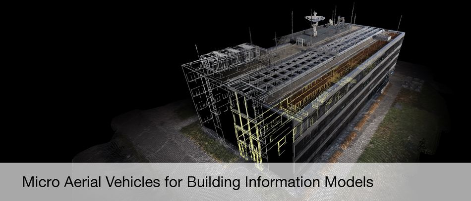
- Autonomous Visual Mapping and Exploration with a Micro Aerial Vehicle. Journal of Field Robotics 31 (4), 2014, 654--675 mehr…
- Structure-From-Motion for MAV Image Sequence Analysis with Photogrammetric Applications. International Archives of the Photogrammetry, Remote Sensing and Spatial Information Sciences (ISPRS) XL-3, 2014, 305--312 mehr…
- High-Resolution Estimation of Ionospheric Phase Screens through Semi-Focusing Processing. Proceedings of the International Geoscience and Remote Sensing Symposium (IGARSS), 2014, 17--20 mehr…
- Reconstructing 2-D/3-D Building Shapes From Spaceborne Tomographic SAR Point Clouds. 3rd ISPRS Commission Symposium on Photogrammetric Computer Vision (PCV), 2014 mehr…
- Superresolving SAR Tomography for Multidimensional Imaging of Urban Areas: Compressive Sensing-based TomoSAR Inversion. IEEE Signal Processing Magazine 31 (4), 2014, 51--58 mehr…
- Advanced Particle Filtering for Airborne Vehicle Tracking in Urban Areas. IEEE Geoscience and Remote Sensing Letters 11 (3), 2014, 686--690 mehr…
- Advanced Particle Filtering for Airborne Vehicle Tracking in Urban Areas. IEEE Geoscience and Remote Sensing Letters 11 (3), 2014, 686--690 mehr…
- Joint Sparsity Model for Multilook Hyperspectral Image Unmixing. IEEE Geoscience and Remote Sensing Letters 12 (4), 2014, 696--700 mehr…
- Vision-Controlled Micro Flying Robots: From System Design to Autonomous Navigation and Mapping in GPS-Denied Environments. IEEE Robotics Automation Magazine 21 (3), 2014, 26--40 mehr…
- Automatic SAR Simulation Technique for Object Identification in Complex Urban Scenarios. IEEE Journal of Selected Topics in Applied Earth Observations and Remote Sensing 7 (3), 2014, 994--1003 mehr…
- An Efficient Tomographic Inversion Approach for Urban Mapping Using Meter Resolution SAR Image Stacks. IEEE Geoscience and Remote Sensing Letters 11 (7), 2014, 1250--1254 mehr…
- Façade Reconstruction using Multiview Spaceborne TomoSAR Point Clouds. IEEE Transactions on Geoscience and Remote Sensing 52 (6), 2014, 3541--3552 mehr…
- A Homography Formulation to the 3pt Plus a Common Direction Relative Pose Problem. In: Springer International Publishing, 2014, 288--301 mehr…
- A Homography Formulation to the 3pt Plus a Common Direction Relative Pose Problem. In: Springer International Publishing, 2014, 288--301 mehr…
- Temporal Video Segmentation by Event Detection: A Novelty Detection Approach. Pattern Recognition and Image Analysis (PRIA) 24 (2), 2014, 243--255 mehr…
- Regularized Geometric Hulls for Robust Cell Nucleus Segmentation from Microscopy Images. Proceedings of the 18th Annual Conference on Medical Image Understanding and Analysis (MIUA), 2014 mehr…
- Quantitative Analysis of Pathological Mitochondrial Morphology in Neuronal Cells in Confocal Laser Scanning Microscopy Images. Proceedings of the 2th International Work-Conference on Bioinformatics and Biomedical Engineering (IWBBIO), 2014 mehr…
- A Graph-based MAP Solution for Multi-Person Tracking Using Multi-Camera Systems. Proceedings of the 9th International Conference on Computer Vision Theory and Applications (VISAPP), 2014 mehr…
- Tomo-GENESIS: DLR's Tomographic SAR Processing System. In: Proceedings of Joint Urban Remote Sensing Event (JURSE), 2013 mehr…
- Fusion of Hyperspectral Images and Height Models Using Edge Probability. Proceedings of the 5th Workshop on Hyperspectral Image and Signal Processing: Evolution in Remote Sensing, Gainesville, Florida, USA., 2013 mehr…
- Sparse Spectral Unmixing with Endmember Groups Pre-Selection. Proceedings of the 5th Workshop on Hyperspectral Image and Signal Processing: Evolution in Remote Sensing, Gainesville, Florida, USA., 2013 mehr…
- Robust Building Façade Reconstruction From Spaceborne TomoSAR Points. Proceedings of Object Extraction for 3D City Models, Road Databases and Traffic Monitoring - Concepts, Algorithms, and Evaluation (CMRT 2013), Antalya, Turkey, 2013 mehr…
- Sparse Reconstruction techniques for Tomographic SAR Inversion. Proceedings of the 2013 European Signal Processing Conference (EUSIPCO-2013), Marrakech, Morocco., 2013 mehr…
- Collabrative Sparse Image Fusion with Application to Pan-Sharpening. Proceedings of the International Conference on Digital Signal Processing (DSP2013), Santorini, Greece., 2013 mehr…
- Line-Based Registration of DSM and Hyperspectral Images. ISPRS Hannover Workshop 2013: High-Resolution Earth Imaging for Geospatial Information., 2013 mehr…
- Evaluation of Persistent Scatterer Patterns at Building Facades by Simulation Techniques. ISPRS Hannover Workshop 2013: High-Resolution Earth Imaging for Geospatial Information, 7-12., 2013 mehr…
- Application of Distributed Compressive Sensing in Hyperspectral Image Unmixing. Proceedings of the 8th EARSeL Imaging Spectrometry Workshop, Nantes, France, 2013 mehr…
- Scientific Visualization for 4-D Building Deformation Data Analysis. Proceedings of the 26th International Cartographic Conference, Dresden, Germany, 2013 mehr…
- Jointly Sparse Fusion of Hyperspectral and Multispectral Imagery. Proceedings of IGARSS'13 Conference, Melbourne, 2013 mehr…
- Reconstruction of building facades using spaceborne multiview TomoSAR point clouds. Proceedings of IGARSS'13 Conference, Melbourne, 2013 mehr…
- Object-based Change Detection for Individual Buildings in SAR Images Captured with Different Incidence Angles. Proceedings of IGARSS'13 Conference, Melbourne, 2013 mehr…
- Feature-Based Fusion of TomoSAR Point Clouds from Multi-view TerraSAR-X Data Stacks. Proceedings of IGARSS'13 Conference , Melbourne, 2013 mehr…
- Collaborative Sparse Reconstruction for Pan-Sharpening. Proceedings of IGARSS'13 Conference, Melbourne, 2013 mehr…
- Tomographic Urban Imaging using TerraSAR-X High Resolution Spotlight Data Stacks. ESA Living Planet Symposium, Edinburgh, United Kingdom, 2013 mehr…
- Confidence-Based Surface Prior for Energy-Minimization Stereo Matching. German Conference on Pattern Recognition (DAGM), 2013 mehr…
- Building Façades Reconstruction Using Multi-View TomoSAR Point Clouds. In: Proceedings of Joint Urban Remote Sensing Event (JURSE), 2013 mehr…
- Towards TerraSAR-X Street View: Creating City Point Cloud from Multi-aspect Data Stacks. In: Proceedings of Joint Urban Remote Sensing Event (JURSE), 2013 mehr…
- Multi-Modal and Multi-Temporal Data Fusion: Outcome of the 2012 GRSS Data Fusion Contest. IEEE Journal of Selected Topics in Applied Earth Observations and Remote Sensing (6(3)), 2013, 1324-1340 mehr…
- Analysis of Interpolation Schemes for the Accurate Estimation of Energy Spectrum in Lagrangian Methods. Computers & Fluids (82(8)), 2013, 122-131 mehr…
- Advanced Particle Filtering for Airborne Vehicle Tracking in Urban Areas. IEEE Geoscience and Remote Sensing Letters (11(3)), 2013, 686-690 mehr…
- A Sparse Image Fusion Algorithm with Application to Pan-sharpening. IEEE Transactions on Geoscience and Remote Sensing (51(5)), 2013, 2827-2836 mehr…
- Globale Kartierung und lokale Deformationsmessungen mit den Satelliten TerraSAR-X und Tandem-X. Zeitschrift für Geodäsie, Geoinformation und Landmanagement (zfv) (1), 2013, 75-84 mehr…
- Accurate 3D Multi-Marker Tracking in X-ray Cardiac Sequences Using a Two-Stage Graph Modeling Approach. Computer Analysis of Images and Patterns (CAIP) (Lecture Notes in Computer Science), Springer, 2013 mehr…
- JAR-Aibo: A Multi-View Dataset for Evaluation of Model-Free Action Recognition Systems. New Trends in Image Analysis and Processing (ICIAP) (Lecture Notes in Computer Science), Springer, 2013 mehr…
- Temporal Self-Similarity for Appearance-Based Action Recognition in Multi-View Setups. Computer Analysis of Images and Patterns (CAIP) (Lecture Notes in Computer Science), Springer, 2013 mehr…
- Oriented Differences of Boxes Operators for Blood Vessel Segmentation and Analysis in Confocal Laser Endomicroscopy Images with Minimal User Interaction. Proceedings of the 17th Annual Conference on Medical Image Understanding and Analysis (MIUA), 2013 mehr…
- Hierarchical Dirichlet Processes for Unsupervised Online Multi-View Action Perception using Temporal Self-Similarity Features. Proceedings of the 7th ACM/IEEE International Conference on Distributed Smart Cameras (ICDSC), 2013 mehr…
- On The Use Of Overcomplete Dictionaries For Spectral Unmixing. Proceedings of the 4th Workshop on Hyperspectral Image and Signal Processing: Evolution in Remote Sensing, Shanghai, China, 2012 mehr…
- Evaluation of Stereo Matching Costs on Close Range, Aerial and Satellite Images. International Conference on Pattern Recognition Applications and Methods, 2012 mehr…
- Efficient Dense Stereo Matching using CUDA. GPU Technology Conference, 2012 mehr…
- From TomoSAR Point Clouds to Objects: Façade Reconstruction. Proceeding of the Tyrrhenian Workshop on Advances in Radar and Remote Sensing (TyWRRS 2012), Naples, Italy, 2012 mehr…
- A Pan-sharpening Algorithm Based on Joint Sparsity. Proceeding of the Tyrrhenian Workshop on Advances in Radar and Remote Sensing (TyWRRS 2012), Naples, Italy, 2012 mehr…
- Characterization of SAR Image Patterns Pertinent to Individual Facades. Proceedings of IGARSS'12 Conference, 2012, Munich, 2012 mehr…
- Sparse Approximation, Coherence and Use of Derivatives in Hyperspectral Unmixing. Proceedings of the Third Annual Hyperspectral Imaging Conference, Rome, Italy, 2012 mehr…
- SAR-EDU - A German Education Inititiative for Applied Synthetic Aperture Radar Remote Sensing. Proceedings of IGARSS'12 Conference, 2012, Munich, 2012 mehr…
- Phase Unwrapping Correction with Dual-baseline Data for the TanDEM-X Mission. Proceedings of IGARSS'12 Conference, 2012, Munich, 2012 mehr…
- Towards an Urban DEM Generation with Satellite SAR Interferometry. In: Proceedings of XXII ISPRS Congress, Melbourne, Australia, 2012 mehr…
- Stacks Facade Structure Reconstruction using Spaceborne TomoSAR Point Clouds. Proceedings of IGARSS'12 Conference, 2012, Munich, 2012 mehr…
- Change detection for SAR images captured with different incidence angles (abstract only). Proceedings of IGARSS'12 Conference, 2012, Munich, 2012 mehr…
- Detecting changes between a DSM and a high resolution SAR image with the support of simulation based separation of urban scenes. Proceedings of EUSAR Conference, 2012, Nuremberg., 2012 mehr…
- Operational TomoSAR Processing Using Multitrack TerraSAR-X High Resolution Spotlight Data Stacks. Proceedings of IGARSS'12 Conference, 2012, Munich, 2012 mehr…
- Near Real-time SAR Change Detection using CUDA. Proceedings of IGARSS'12 Conference, 2012, Munich, 2012 mehr…
- Super-resolution of Sparse Reconstruction for Tomographic SAR Imaging - Demonstration with Real Data. Proceedings of EUSAR Conference, 2012, Nuremberg., 2012 mehr…
- Tomographic SAR Inversion from Mixed Repeat- and Single-Pass Data Stacks the TerraSAR-X/TanDEM-X Case. In: Proceedings of XXII ISPRS Congress, Melbourne, Australia, 2012 mehr…
- Sparse Tomographic SAR Reconstruction from Mixed TerraSAR-X/TanDEM-X Data Stacks. Proceedings of IGARSS'12 Conference, 2012, Munich, 2012 mehr…
- Integration of Tomographic SAR Inversion and PSI for Operational Use. Proceedings of EUSAR Conference, 2012, Nuremberg., 2012 mehr…
- Complex Event Detection in Pedestrian Groups from UAVs. ISPRS Ann. Photogramm. Remote Sens. Spatial Inf. Sci., 2012 mehr…
- Spectral Information Retrieval for Sub-Pixel Building Detection. ISPRS Ann. Photogramm. Remote Sens. Spatial Inf. Sci., 2012 mehr…
- Graph-Based Analysis of Pedestrian Interactions and Events Using Hidden Markov Models. Photogrammetrie, Fernerkundung, Geoinformation 6, 2012, 701-710 mehr…
- Deformation monitoring of single buildings using meter-resolution SAR data in PSI. ISPRS Journal of Photogrammetry and Remote Sensing 73, 2012, 68-79 mehr…
- Retrieval of Phase History Parameters from Distributed Scatterers in Urban Areas Using Very High Resolution SAR Data. ISPRS Journal of Photogrammetry and Remote Sensing 73, 2012, 89-99 mehr…
- Samodejna koregistracija trirazseznih modelov stavb z graficnimi gradniki na podobah: Automatic Coregistration of Three-Dimensional Building Models with Image Features. Geodetski Vestnik, Association of Surveyors of Slovenia 56 (1), 2012, 41-56 mehr…
- Network Snakes: Graph-based Object Delineation with Active Contour Models. Machine Vision and Applications 23 (1), 2012, 91-109 mehr…
- Imaging GeodesyCentimeter-Level Ranging Accuracy With TerraSAR-X: An Update. IEEE Geoscience and Remote Sensing Letters 9 (5), 2012, 948-952 mehr…
- Probabilistic Graphical Models for Flood State Detection of Roads Combining Imagery and DEM. IEEE Geoscience and Remote Sensing Letters 9 (6), 2012, 1051-1055 mehr…
- Geometrical Fusion of Multitrack PS Point Clouds. IEEE Geoscience and Remote Sensing Letters 9 (1), 2012, 38-42 mehr…
- Ground Displacement Measurement by TerraSAR-X Image Correlation: The 2011 Tohoku-Oki Earthquake. IEEE Geoscience and Remote Sensing Letters 9 (4), 2012, 539-543 mehr…
- Super-Resolution Power and Robustness of Compressive Sensing for Spectral Estimation with Application to Spaceborne Tomographic SAR. IEEE Transactions on Geoscience and Remote Sensing 50 (1), 2012, 247-258 mehr…
- Demonstration of Super-resolution for Tomographic SAR Imaging in Urban Environment. IEEE Transactions on Geoscience and Remote Sensing 50 (8), 2012, 3150-3157 mehr…
- Data Association for Multi-Object Tracking-by-Detection in Multi-Camera Networks. Proceedings of the 6th ACM/IEEE International Conference on Distributed Smart Cameras (ICDSC), 2012 mehr…
- Analyzing the Subspaces Obtained by Dimensionality Reduction for Human Action Recognition from 3d Data. Proceedings of the 9th IEEE International Conference on Advanced Video and Signal-Based Surveillance (AVSS), 2012 mehr…
- Scale-Independent Spatio-Temporal Statistical Shape Representations for 3d Human Action Recognition. Proceedings of the 1st International Conference on Pattern Recognition Applications and Methods (ICPRAM), SciTePress, 2012 mehr…
- Event Detection based on a Pedestrian Interaction Graph using Hidden Markov Models. In: Stilla, Rottensteiner, Mayer, Jutzi, Butenuth (eds.), Photogrammetric Image Analysis, Lecture Notes in Computer Science, Springer, 2011, 271-284 mehr…
- A Performance Study on Different Stereo Matching Costs using Airborne Image Sequences and Satellite images. In: Stilla, Rottensteiner, Mayer, Jutzi, Butenuth (eds.), Photogrammetric Image Analysis, Lecture Notes in Computer Science, Springer, 2011, 159-170 mehr…
- Photogrammetric Image Analysis. . Springer, Lecture Notes in Computer Science 6952, 2011 mehr…
- Real-time Object Detection with Subpixel Accuracy using the Level Set Method. 4th TerraSAR-X Scientific Meeting, 2011 mehr…
- Peculiarities of urban area analysis with very high resolution interferometric SAR data. JURSE 2011, 2011 mehr…
- Within the Resolution Cell: Super-Resolution in Tomographic SAR Imaging. Int. Geosci. Remote Sensing Symp., IGARSS 2011, 2011 mehr…
- Multi-Component Nonlinear Motion Estimation in Differential SAR Tomography – The Time Warp Method. Int. Geosci. Remote Sensing Symp., IGARSS 2011, 2011 mehr…
- Ionospheric Effects in SAR Interferometry: An Analysis and Comparison of methods for their estimation. Int. Geosci. Remote Sensing Symp., IGARSS 2011, 2011 mehr…
- Hyperspectral Image Resolution Enhancement Based on Spectral Unmixing and Information Fusion. ISPRS Hannover Workshop 2011: High-Resolution Earth Imaging for Geospatial Information Hannover, Germany, 2011 mehr…
- Spectral Matching through Data Compression. ISPRS Hannover Workshop 2011, High-Resolution Earth Imaging for Geospatial Information, 2011 mehr…
- Photogrammetric Image Analysis. . The International Archives of the Photogrammetry, Remote Sensing and Spatial Information Science, 2011 mehr…
- Towards Geodetic Measurements From SAR Satellites. Fragile Earth, 2011 mehr…
- Detection of the Volcanic Deformation with Multi-Stack Persistent Scatterer Interferometry using TerraSAR-X Data. EGU 2011, 2011 mehr…
- Tandem-L: A Radar Mission Proposal to Capture Earth Dynamics. Fragile Earth, 2011 mehr…
- A bound for super-resolution power of compressive sensing imaging systems. SIAM conference on optimization 2011, 2011 mehr…
- Compressive sensing for pan-sharpening. International Symposium on Image and Data Fusion 2011, 2011 mehr…
- The SL1MMER algorithm for spectral estimation -- with application to tomographic SAR inversion. SIAM conference on optimization 2011, 2011 mehr…
- 3-D and 4-D Tomographic Urban Mapping using TerraSAR-X Spotlight Data. 4th TerraSAR-X Scientific Meeting, 2011 mehr…
- Tomographic SAR inversion via sparse reconstruction. SPARS 11, 2011 mehr…
- Trafficability Analysis after Flooding in Urban Areas using Probabilistic Graphical Models. JURSE 2011 - Joint Urban Remote Sensing Event, 2011, 345-348 mehr…
- An Adaptive Particle Filter Method for Tracking Multiple Interacting Targets. IAPR Conference on Machine Vision Applications, 2011, 6-9 mehr…
- Tracking Multiple Vehicles in Airborne Image Sequences of Complex Urban Environments. JURSE 2011 - Joint Urban Remote Sensing Event, 2011, 13-16 mehr…
- Interpretation of SAR Images in Urban Areas Using Simulated Optical and Radar Images. JURSE 2011 - Joint Urban Remote Sensing Event 2011, 2011, 41-44 mehr…
- Towards multi-layer pedestrian interaction models for simulation, tracking, interpretation and indoor navigation. 23rd European Conference Forum Bauinformatik, 2011, 123-131 mehr…
- Multi-Temporal Damage Assessment of Linear Infrastructural Objects Using Dynamic Bayesian Networks. IEEE International Workshop on the Analysis of Multi-Temporal Remote Sensing Images, 2011, 61-64 mehr…
- Real-time Object Detection with Subpixel Accuracy using the Level Set Method. The Photogrammetric Record 26 (134), 2011, 154-170 mehr…
- Imaging Geodesy-Toward Centimeter-Level Ranging Accuracy With TerraSAR-X. IEEE Transactions on Geoscience and Remote Sensing 49 (2), 2011, 661-671 mehr…
- Monitoring of Individual Ground Structures with Very High-Resolution Satellite Synthetic Aperture Radar: Results with the TerraSAR-X System. EGU 2011, 2011 mehr…
- Let's Do the Time Warp: Multicomponent Nonlinear Motion Estimation in Differential SAR Tomography. Geoscience and Remote Sensing Letters, IEEE 8 (4), 2011, 735 -739 mehr…
- Tomographic Imaging and Monitoring of Buildings with Very High Resolution SAR Data. IEEE Geoscience and Remote Sensing Letters 8 (4), 2011, 661--665 mehr…
- Investigations on the Nature of Persistent Scatterers Based on Simulation Methods. JURSE 2011, 2011, 61--64 mehr…
- 4D city information - fusion of multi-aspect angle high resolution PS point clouds. JURSE 2011, 2011, 57--60 mehr…
- Compressive sensing for image fusion ? with application to pan-sharpening. IGARSS 2011 (Geoscience and Remote Sensing Symposium (IGARSS), 2011 IEEE International), 2011, 2793--2796 mehr…
- Ghost Persistent Scatterers Related to Signal Reflections Between Adjacent Buildings. International Geoscience and Remote Sensing Symposium (IGARSS), IEEE, 2011, 1485--1488 mehr…
- Advanced coherence stacking technique using high resolution TerraSAR-X spotlight data. URBAN 2011 - URS 2011 (Urban Remote Sensing Event (JURSE), 2011 Joint), IEEE, 2011, 233 --236 mehr…
- Optimal estimation of distributed scatterer phase history parameters from meter-resolution SAR data. IGARSS 2011 (Geoscience and Remote Sensing Symposium (IGARSS), 2011 IEEE International), IEEE, 2011, 3468--3471 mehr…
- Peculiarities of urban area analysis with very high resolution interferometric SAR data. URBAN2011-URS2011 (Urban Remote Sensing Event (JURSE), 2011 Joint), IEEE, 2011, 185--188 mehr…
- Sparse reconstruction techniques for SAR tomography. DSP 2011 (Digital Signal Processing (DSP), 2011 17th International Conference on), IEEE, 2011, 1--8 mehr…
- A fundamental bound for super-resolution - with application to 3D SAR imaging. URBAN2011-URS2011 (Urban Remote Sensing Event (JURSE), 2011 Joint), IEEE, 2011, 181--184 mehr…
- Orthorectification of VHR optical satellite data exploiting the geometric accuracy of TerraSAR-X data. ISPRS Journal of Photogrammetry and Remote Sensing 66 (1), 2011, 124--132 mehr…
- Ghost Persistent Scatterers Related to Multiple Signal Reflections. IEEE Geoscience and Remote Sensing Letters 8 (5), 2011, 919--923 mehr…
- A Method for Fast Composing of Images Captured from Deformed Documents by a Quadocular Scanner Setup. Proceedings of the 12th IAPR Conference on Machine Vision Applications (MVA), 2011 mehr…
- Advanced techniques and new high resolution SAR sensors for monitoring urban areas. IGARSS 2010, 2010 mehr…
- Compressive Sensing For High Resolution Differential SAR Tomography - The Slimmer Algorithm. IGARSS 2010, 2010 mehr…
- Towards Deformation Monitoring of Single Buildings - Persistent Scatterer Interferometry using TerraSAR-X Very High Resolution Spotlight Data. Proceedings of EUSAR 2010, 2010 mehr…
- Minimum Cost Flow phase unwrapping supported by multibaseline unwrapped gradient. Proceedings of EUSAR 2010, 2010 mehr…
- High Resolution TerraSAR-X Data versus Medium Resolution L-Band Data for Crustal Deformation InSAR. EGU General Assembly 2010, 2010 mehr…
- Space-Time Tomographic Infrastructure Reconstruction via Compressive Sensing Using TerraSAR-X High Resolution Spotlight Data. Proceedings of International Workshop Spatial Information Technologies for Monitoring the Deformation of Large-Scale Man-made Linear Features, 2010 mehr…
- Tandem-L: A Mission for Monitoring Earth System Dynamics with High Resolution SAR Interferometry. Proceedings of EUSAR Conference, 2010 mehr…
- Least Squares Estimation of PSI Networks for Large Scenes with Multithreaded Singular Value Decomposition. Proceedings of EUSAR Conference, 2010 mehr…
- Monitoring of volcanic eruptions and determination of SO2 plume height from GOME-2 measurements. In: Proceedings of the ESA Living Planet Symposium, ESA, SP-686, 2010 mehr…
- Multibaseline Gradient Ambiguity Resolution To Support Minimum Cost Flow Phase Unwrapping. Proceedings of the 2010 IEEE International Geoscience and Remote Sensing Symposium, 2010, 4411-4414 mehr…
- Estimation and compensation of ionospheric delay for SAR Interferometry. Proceedings of 2010 IEEE International Geoscience and Remote Sensing Symposium (IEEE Geoscience and Remote Sensing Symposium,2010 IEEE International,IGARSS 2010), 2010 mehr…
- People Tracking and Trajectory Interpretation in Aerial Image Sequences. International Archives of Photogrammetry, Remote Sensing and Spatial Information Sciences, Comm. III (Part A), 2010, 209-214 mehr…
- Assessment System of GIS-Objects using Multi-Temporal Imagery for Near-Realtime Disaster Management. International Archives of Photogrammetry, Remote Sensing and Spatial Information Sciences XXXVIII (Part A), 2010, 43-48 mehr…
- Comparison of Dense Stereo using CUDA. Prceedings of ECCV, Workshop Computer Vision on GPUs, 2010, on CD mehr…
- Geometric Refinement of Road Networks using Network Snakes and SAR Images. Proceedings of IGARSS 2010, 2010, 449-452 mehr…
- Estimation and Compensation of Ionospheric Delay for SAR Interferometry. Proceedings of IGARSS 2010, 2010, 2908-2911 mehr…
- Diverse Methods to Monitoring Volcanic Deformation Based on SAR Interferometry. Proceedings of IGARSS 2010, 2010, 4403-4406 mehr…
- Tandem-L: An Innovative Interferometric and Polarimetric SAR Mission to Monitor Earth System Dynamics with High Resolution. Proceedings of IGARSS 2010, 2010, 253-256 mehr…
- Visual Identification of Scattered Crowd Movement Patterns Using a Directed Kernel Density Estimation. Proceedings of SPM2010 Mobile Tartu, 2010, on CD mehr…
- Computational Optimized 3D Reconstruction System for Airborne Image Sequences. International Archives of Photogrammetry, Remote Sensing and Spatial Information Sciences, Comm. I, 2010, on CD mehr…
- SIGNAL: Mission Concept and Performance Assessment. Proceedings of European Conference on Synthetic Aperture Radar (EUSAR), VDE Verlag GmbH, 2010, 520-523 mehr…
- Multi Beam Joined Estimation For Persistent Scatterer Interferometry. IGARSS 2010 (Proceedings of IGARSS 2010), IEEE, 2010 mehr…
- Evaluierung effizienter Methoden zur Berechnung des optischen Flusses. Photogrammetrie Fernerkundung Geoinformation 1, 2010, 5-18 mehr…
- A Modular System for Road Updating, Refinement and Classification from Satellite Images. Photogrammetrie Fernerkundung Geoinformation 6, 2010, 453-464 mehr…
- Automatic Road-Tracking in Airborne Image Sequences. Photogrammetrie Fernerkundung Geoinformation 5, 2010, 325-336 mehr…
- Ray-Tracing Simulation Techniques For Understanding High-Resolution SAR Images. IEEE Transactions on Geoscience and Remote Sensing 48, 2010, 1445-1456 mehr…
- Very High Resolution Spaceborne SAR Tomography in Urban Environment. IEEE Transactions on Geoscience and Remote Sensing 48 (12), 2010, 4296-4308 mehr…
- Tomographic SAR Inversion by L1 Norm Regularization - The Compressive Sensing Approach. IEEE Transactions on Geoscience and Remote Sensing 48 (10), 2010, 3839-3846 mehr…
- Extraction and Geometrical Accuracy of Double-bounce Lines in High Resolution SAR Images. Photogrammetric Engineering and Remote Sensing 76 (9), 2010, 1071-1080 mehr…
- 3D SAR Simulation of Urban Areas Based on Detailed Building Models. Photogrammetric Engineering & Remote Sensing 76 (12), 2010, 1373-1384 mehr…
- Image acquisition geometry analysis for the fusion of optical and radar remote sensing data. International Journal of Image and Data Fusion 1 (3), 2010, 271-282 mehr…
- Potential of Very High Resolution SAR for Persistent Scatterer Interferometry in Urban Areas. Annals of GIS 16 (2), 2010, 103-111 mehr…
- Deformation Monitoring using SAR Interferometry on the Azores within Exupéry Project. In: Proceedings of FRINGE 2009 Workshop, 2009 mehr…
- Automated Detection and Classification of Intact Road Networks in Multi-sensorial Spaceborne Imagery for Near-realtime Disaster Management. Proceedings of the IEEE International Geoscience & Remote Sensing Symposium (IGARSS), 2009 mehr…
- Near real time airborne monitoring system for disaster and traffic applications. Proceedings of ISPRS Hannover Workshop, 2009 mehr…
- First Results from Multifrequency Interferometry. A comparison of different decorrelation time constants at L, C, and X Band. (SP-677), ESA Scientific Publications, 2009 mehr…
- Operational monitoring of SO2 emissions using the GOME-2 satellite instrument. 2009 EUMETSAT Meteorological Satellite Conference, 2009 mehr…
- Operational monitoring of SO2 emissions using the GOME-2 satellite instrument. Atmospheric Science Conference, 2009 mehr…
- Traffic Monitoring without single Car Detection from optical airborne Images. ISPRS Hannover Workshop, 2009 mehr…
- Object extraction based on 3d-segmentation of LiDAR data by combining mean shift with normalized cuts: two examples from urban areas. Proceedings of 2009 Urban Remote Sensing Joint event (URBAN2009 - URS2009), 2009 mehr…
- Unveiling Short-Term Dynamic of Urban Areas with Airborne LiDAR Data for Change Detection. Proceedings of the 2nd International Conference on Earth Observation for Global Changes (EOGC2009), 2009 mehr…
- Analysis of Road Networks after Flood Disasters using Multi-sensorial Remote Sensing Techniques. Proceedings of the 2nd International Conference on Earth Observation for Global Changes (EOGC), 2009, 1398-1405 mehr…
- Classification System of GIS-Objects using Multi-Sensorial Imagery for Near-Realtime Disaster Management. International Archives of Photogrammetry, Remote Sensing and Spatial Information Sciences, 2009, 103-108 mehr…
- Refining Correctness of Vehicle Detection and Tracking in Aerial Image Sequences by means of Velocity and Trajectory Evaluation. International Archives of Photogrammetry, Remote Sensing and Spatial Information Sciences, 2009, 181-186 mehr…
- Vehicle Activity Indication from Airborne LiDAR Data of urban Areas by Binary Shape Classification of Point Sets. International Archives of Photogrammetry, Remote Sensing and Spatial Information Sciences, 2009, 35-40 mehr…
- Near-Realtime Classification of Intact Road Networks for Disaster Management using Multi-sensorial Spaceborne Imagery. Publikationen der Deutschen Gesellschaft für Photogrammetrie, Fernerkundung und Geoinformation, 2009, 69-77 mehr…
- An image engineering system for the inspection of transparent construction materials. ISPRS Journal of Photogrammetry and Remote Sensing, Elsevier B.V, 2009, 297-307 mehr…
- Delta-k Wideband SAR Interferometry for DEM Generation and Persistent Scatterers using TerraSAR-X Data. FRINGE 2009 Workshop, 2009 mehr…
- First Demonstration of Space-borne High Resolution SAR Tomography in Urban Environment Using TerraSAR-X Data. CEOS SAR Workshop on Calibration and Validation 2008, 2009 mehr…
- Very High ResolutionSAR Tomography via Compressive Sensing. FRINGE 2009, 2009 mehr…
- Space-borne High Resolution SAR Tomography: Experiments in Urban Environment Using TerraSAR-X Data. Urban Remote Sensing Joint event (JURSE) 2009, 2009 mehr…
- Coherent Stacking with TerraSAR-X Imagery in Urban Areas. IEEE - ISPRS Joint Urban Remote Sensing Event, 2009 mehr…
- Analysis of Image Sequences for the Detection and Monitoring of Moving Traffic. Photogrammetrie Fernerkundung Geoinformation 5, 2009, 421-430 mehr…
- Enhanced Automated Canopy Characterization from Hyperspectral Data by a Novel Two Step Radiative Transfer Model Inversion Approach. Remote Sensing 1, 2009, 1139-1170 mehr…
- Processing System and Algorithm for the TanDEM-X Mission. IGARSS 2009, 2009 mehr…
- Space-Borne High Resolution Tomographic Interferometry. IGARSS 2009, 2009 mehr…
- Techniques and Examples for the 3D Reconstruction of complex Scattering Situations using TerraSAR-X. IGARSS 2009, 2009 mehr…
- TerraSAR-X High Resolution Spotlight Persistent Scatterer Interferometry. Fringe 2009, 2009 mehr…
- Coherent Stacking with TerraSAR-X Imagery in Urban Areas. 2009 Urban Remote Sensing Joint Event, 2009 mehr…
- Very high Resolution SAR tomography via Compressive Sensing. Fringe 2009, 2009 mehr…
- Appearance of Persistent Scatterers for Different TerraSAR-X Acquisition Modes. ISPRS, 2009 mehr…
- 3D Analysis of Scattering Effects Based on Ray Tracing Techniques. IGARSS'09, 2009 mehr…
- Ray Tracing and SAR Tomography for 3D Analysis of Microwave Scattering at Man-Made Objects. ISPRS Workshop on City Models, Roads and Traffic (CMRT), 2009 mehr…
- Satellite Monitoring of Volcanic Sulfur Dioxide Emissions for Early Warning of Volcanic Hazards. IEEE Journal of Selected Topics in Applied Earth Observations and Remote Sensing 2 (3), 2009, 196-206 mehr…
- Analysis of Image Sequences for the Detection and Monitoring of Moving Traffic. Photogrammetrie Fernerkundung Geoinformation 5, 2009, 421-430 mehr…
- Interferometric Absolute Phase Determination with TerraSAR-X Wideband SAR Data. RadarCon09, IEEE, 2009 mehr…
- Using Geometric Accuracy of TerraSAR-X Data for Improvement of Direct Sensor Orientation and Ortho-Rectification. IGARSS 2009 (IGARSS Symposia), IEEE, 2009 mehr…
- Absolute Phase Estimation from TerraSAR-X Acquisitions using Wideband Interferometry. CEOS SAR 2008, 2009 mehr…
- Scientific Requirements and Feasibility on an L-band Mission dedicated to Measure Surface Deformation. IEEE IGARSS 2009, Cape Town, IEEE, 2009 mehr…
- Enhanced Automated Canopy Characterization from Hyperspectral Data by a Novel Two Step Radiative Transfer Model Inversion Approach. International Journal of Remote Sensing 1, 2009, 1139--1170 mehr…
- Interferometric Potential of High Resolution Spaceborne SAR. Photogrammetrie Fernerkundung Geoinformation (5), 2009, 403--415 mehr…
- The Tandem-L Mission Proposal: Monitoring Earth's Dynamics with High Resolution SAR Interferometry. IEEE Radar Conference (RadarCon), IEEE, 2009, 6 mehr…
- Spaceborne Spotlight SAR Interferometry With TerraSAR-X. IEEE Transactions on Geoscience and Remote Sensing Vol. 47 (Issue 5), 2009, 1524--1535 mehr…
- Traffic monitoring from airborne LiDAR - feasibility, simulation and analysis. XXI Congress, Proceedings. International Archives of Photogrammetry, Remote Sensing and Spatial Geoinformation Sciences (ISPRS 2008), 2008 mehr…
- Automatic analysis of traffic scenario from airborne thermal infrared video. XXI Congress, Proceedings. International Archives of Photogrammetry, Remote Sensing and Spatial Geoinformation Sciences (ISPRS 2008), 2008 mehr…
- Automatic vehicle extraction from airborne LiDAR data of urban areas using morphological reconstruction. Proceedings of 5th IAPR Workshop on Pattern Recognition in Remote Sensing (PRRS08), 2008 mehr…
- Topology-Preserving Network Snakes. International Archives of Photogrammetry, Remote Sensing and Spatial Information Sciences XXXVII (Part B3a), 2008 mehr…
- Simulation of Radar Reflection at Man-Made Objects and its Benefits for Peristent Scatterer Interferometry. Proceedings of EUSAR 08, Friedrichshafen, 2008 mehr…
- Verification of Intact Road Networks in Satellite Imagery for Crises Applications. In: Eckhard, Seyfert (eds.), Publikationen der Deutschen Gesellschaft für Photogrammetrie Fernerkundung und Geoinformation 17, 2008, 111-117 mehr…
- One year of total ozone and SO2 measurement from GOME-2. Fourth International DOAS Workshop, 2008 mehr…
- Operational O3M-SAF trace-gas column products:GOME-2 tropospheric NO2, Ozone, and total SO2. 7th AT2 workshop, 2008 mehr…
- Absolute Phase Estimation from TerraSAR-X Acquisitions. CEOS SAR, 2008 mehr…
- Upcoming O3M-SAF trace-gas column products: GOME-2 tropospheric NO2, total BrO and SO2. EUMETSAT Meteorological Satellite Conference, 2008, 2008 mehr…
- TerraSAR-X - A New Era of High Resolution Radar Satellites for Earth Observation. Geomatik-Seminar ETZ, 2008 mehr…
- TerraSAR-X - Eine neue Ära der hochauflösenden Radar-Fernerkundung aus dem All. Geodaetisches Kolloquium Uni Karlsruhe, 2008 mehr…
- Erdbeobachtung aus dem Weltraum und aus der Luft. Luft- und Raumfahrt in Bayern, 2008, 16 - 20 mehr…
- Requirements for an L-band InSAR Mission to Monitor Global Tectonic Activities. AGU Fall Meeting 2008, 2008 mehr…
- Absolute Phase Estimation from TerraSAR-X Data using Wideband Interferometry. TerraSAR-X Science Team Meeting 2008, 2008 mehr…
- Monitoring volcanic SO2 emissions using the GOME-2 satellite instrument. EGU General Assembly 2008, 2008 mehr…
- Monitoring volcanic SO2 plumes using the GOME-2 satellite instrument. Statusseminar: Early Warning Systems in Earth Management, 2008 mehr…
- A Comparative Analysis of Tropospheric Water Vapor Measurements from MERIS and SAR. IGARSS 2008, IGARSS, 2008 mehr…
- Advanced Displacement Estimation for PSI Using HiRes SAR Data. IGARSS 2008, IGARSS 2008, 2008 mehr…
- High Resolution Interferometric Stacking with TerraSAR-X. IGARSS 2008, IGARSS, 2008 mehr…
- TerraSAR-X High Resolution SAR Interferometry. EUSAR 2008, EUSAR, 2008 mehr…
- Ray Tracing for Simulating Reflection Phenomena in SAR Images. Geoscience and Remote Sensing Symposium (IGARSS08), 2008 mehr…
- SAR-Interferometrie für geodätische Anwendungen. Allgemeine Vermessungs-Nachrichten 7/2008, 2008, 243 - 252 mehr…
- Earth Observation from Space and from the Air. Luft- und Raumfahrt in Bayern 2008, 2008 mehr…
- Trajectory matching and dispersion modeling of volcanic plumes utilising space-based observations. 2. Workshop on Use of Remote Sensing Techniques for Monitoring Volcanoes and Seismogenic Areas, 2008 mehr…
- Monitoring of volcanic SO2 emissions using the GOME-2 satellite instrument. Second workshop on USE of Remote Sensing Techniques (USEReST) for Monitoring Volcanoes and Seismogenic Areas, 2008 mehr…
- Requirements for an L-band SAR-Mission for global Monitoring of Tectonic Activities. USEReST '08, 2008 mehr…
- The Pyramids of Gizeh Seen by TerraSAR-X A Prime Example For Unexpected Scattering Mechanisms in SAR. Geoscience and Remote Sensing Letters, IEEE 5 (3), 2008, 468 - 470 mehr…
- Processing of TerraSAR-X Payload Data : First Results. SAR Image Analysis, Modeling, and Techniques IX (Proceedings of SPIE 6746), 2007Florenz, 18.09.2007;Conference Chairs: Notarnicola, Claudia;Posa, Francesco mehr…
- Traffic Monitoring with Spaceborne SAR - Theory, Simulations, and Experiments. Computer Vision and Image Understanding 106 (2-3), 2007, 231-244 mehr…
- The TUM-DLR Multimodal Earth Observation Evaluation Benchmark. (anderer Eintrag) mehr…
- Temporal Vegetation Modelling using Long Short-Term Memory Networks for Crop Identification from Medium-Resolution Multi-Spectral Satellite Images. (anderer Eintrag) mehr…
- Multi-temporal land cover classification with sequential recurrent encoders. (anderer Eintrag) mehr…
- Self-attention for raw optical Satellite Time Series Classification. (anderer Eintrag) mehr…