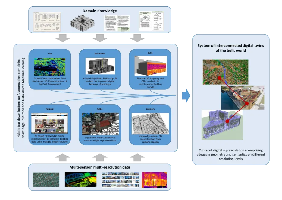
AI4TWINNING stands for the project ‘Artificial Intelligence for the automated creation of multi-scale digital twins of the built environment’. The goal of the project is to create a system of interlinked twins across different scales, providing the opportunity to seamlessly integrate city, district and building models as well as to keep these up-to-date and consistent. This project is being jointly undertaken by 6 chairs at TUM - Chair of Computer Vision and Artificial Intelligence, Chair of Geoinformatics, Chair of Computer Simulation and Modelling, Chair of Architectural Informatics, Chair of Photogrammetry and Remote Sensing, Chair of Data Science and Earth Observation.
Project Description
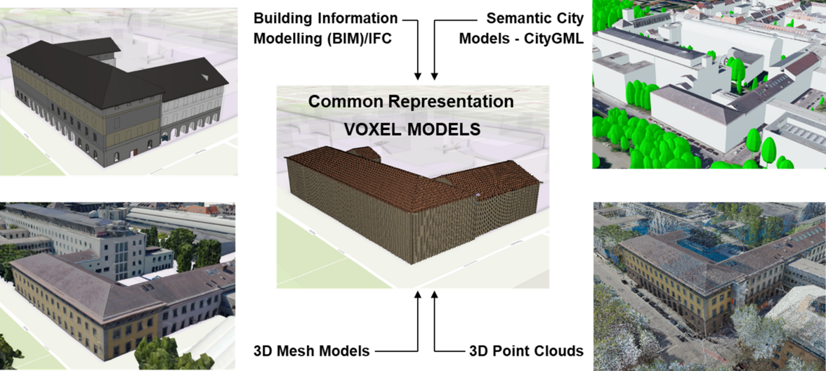
Sub-project of the Chair of Geoinformatics: Digital twin data consistency across multiple representations
The goal of the sub-project is to develop objective measures to assess the level of consistency between various 3D representation types when compared against each other. Consistency measures are required to
enable AI/ML algorithms to learn to reconstruct and segment building objects according to semantic modelling standards,
assess the changes over time,
allow information flow between 3D representations across spatial and temporal scales.
This is achieved by
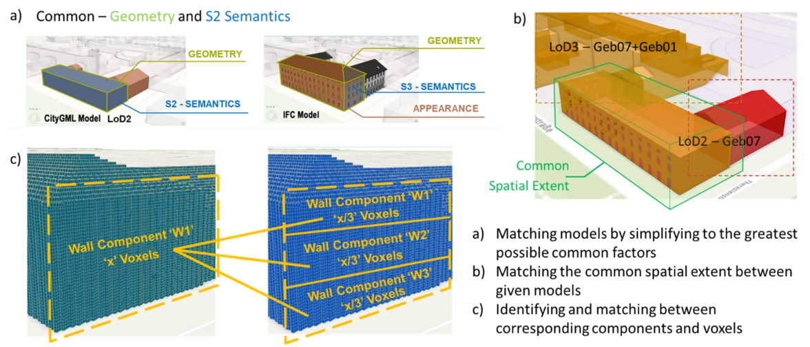
identifying a common representation type that can flexibly accommodate variation in geometry, semantics, levels of detail, and spatial extents, i.e. ‘Volumetric Pixels’ or ‘Voxels’, so that a match can be established,
developing an ontology for matching the various model representations in terms of semantic level of classification, spatial extent, and component-voxel match.
Voxel models as common representation type
Matching voxelised models of various 3D representations
Mehranfar, Mansour; Braun, Alexander; Borrmann, André; Heeramaglore, Medhini; Kolbe, Thomas H.; Chen, Zhaiyu; Zhu, Xiao Xiang: Automatic alignment of semantic building models with digital city models through multi-level point cloud semantic segmentation and registration using PSO optimization: A case study of the TUM main campus. International Journal of Applied Earth Observation and Geoinformation 147, 2026, 105191 mehr…BibTeX
Heeramaglore, Medhini; Kolbe, Thomas H.: Semantically Enriched Voxels as a Common Representation for Comparison and Evaluation of 3D Building Models. Proceedings of the 17th International 3D GeoInfo Conference 2022 (ISPRS Annals of the Photogrammetry, Remote Sensing and Spatial Information Sciences), 2022 mehr…BibTeX